
Built 1905 (1905) NRHP Reference # 75000604 Added to NRHP 1 July 1975 | Area less than one acre Architectural style Town Lattice Opened 1905 | |
 | ||
Similar Cromer's Mill Covered, Red Oak Creek Covered, Coheelee Creek Covered, Auchumpkee Creek Covered, Watson Mill Bridge State Park | ||
Howard s covered bridge
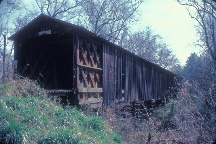
Howard's Covered Bridge is a historic covered bridge outside of Smithonia, Georgia in Oglethorpe County, Georgia. It was added to the National Register of Historic Places on July 1, 1975. The bridge is located 3 miles southeast of Smithonia on SR S2164. The bridge was built in 1905 in a Town lattice design and is 168 feet (51 m) long. The span travels over Big Clouds Creek. The site is marked by a historical marker posted by the Georgia Historical Society. The bridge was named for the pioneer family that settled in the area in the late 1700s. It was built with convict labor and is fastened with wooden trunnels. The timber used was transported on the Smith and Dunlap Railroad, connecting James Monroe Smith (Georgia farmer)'s farm with the Georgia Railroad at Dunlap, Georgia.
Contents
The site's historical marker is at the southern end of Chandler Silver Road at the intersection with Cloud's Creek Road, 1.3 miles west of the Cloud's Creek Baptist Church marker.