
OS grid reference TL034411 Country England Post town BEDFORD Dialling code 01234 Civil parish Houghton Conquest | Region East Sovereign state United Kingdom Postcode district MK45 Ceremonial county Bedfordshire UK parliament constituency Mid Bedfordshire | |
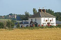 | ||
How End is a hamlet located in the Central Bedfordshire district of Bedfordshire, England.
Map of How End, Bedford, UK
The settlement is close to the larger villages of Stewartby and Houghton Conquest. How End forms part of the Houghton Conquest civil parish (where the 2011 Census population was included).
References
How End Wikipedia(Text) CC BY-SA