
Country United States FIPS code 05-33375 Area 26 ha Population 282 (2013) | Time zone CST (UTC-6) GNIS feature ID 1669459 Elevation 62 m Local time Tuesday 5:38 PM | |
 | ||
Weather 3°C, Wind N at 19 km/h, 66% Humidity | ||
Horseshoe Lake is a town in Crittenden County, Arkansas, United States. The population was 292 at the 2010 census.
Contents
Map of Horseshoe Lake, AR 72348, USA
The town is named after Horseshoe Lake, an oxbow lake at the eastern tip of which the town is located.
Geography
Horseshoe Lake is located in southern Crittenden County at 34°54′46″N 90°18′27″W (34.912702, -90.307523). The Mississippi River is 2 miles (3 km) to the south.
According to the United States Census Bureau, the town has a total area of 0.14 square miles (0.35 km2), all land.
The elevation of Horseshoe Lake is 203 feet (62 m) above sea level.
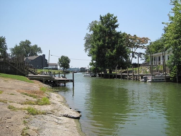
The Horseshoe Lake
The town of Horseshoe Lake is situated in the Mississippi River floodplain at the eastern tip of a U-shaped water body named Horseshoe Lake, which the town is named after. The Lake is a summer recreation spot for residents of nearby Memphis offering boating, swimming, and fishing. Michael "Bubba" Ray is the unofficial Mayor of Horseshoe Lake.
Changes in the course of the Mississippi River resulted in the shape of the lake. The lake is a former meander in the Mississippi River that was cut off, shortening the river, and is no longer connected to the river.
Horseshoe shaped lakes or oxbow lakes are not unusual in the flat plains of the lower Mississippi and other rivers.
Demographics
As of the census of 2000, there were 321 people, 156 households, and 89 families residing in the town. The population density was 885.3/km² (2,264.4/mi²). There were 241 housing units at an average density of 664.6/km² (1,700.1/mi²). The racial makeup of the town was 94.39% White, 5.30% Black or African American, 0.31% from other races. 0.31% of the population were Hispanic or Latino of any race.
There were 156 households out of which 18.6% had children under the age of 18 living with them, 47.4% were married couples living together, 4.5% had a female householder with no husband present, and 42.9% were non-families. 35.9% of all households were made up of individuals and 16.7% had someone living alone who was 65 years of age or older. The average household size was 2.06 and the average family size was 2.65.
In the town, the population was spread out with 17.4% under the age of 18, 4.0% from 18 to 24, 26.2% from 25 to 44, 27.4% from 45 to 64, and 24.9% who were 65 years of age or older. The median age was 47 years. For every 100 females there were 92.2 males. For every 100 females age 18 and over, there were 89.3 males.
The median income for a household in the town was $30,083, and the median income for a family was $36,250. Males had a median income of $29,583 versus $23,750 for females. The per capita income for the town was $17,517. About 4.9% of families and 10.2% of the population were below the poverty line, including 3.9% of those under age 18 and 20.5% of those age 65 or over.