
Area 7.52 km² Local time Tuesday 9:43 PM | Region Ústí nad Labem Postal code 407 57 Elevation 436 m | |
 | ||
Weather 5°C, Wind SW at 6 km/h, 83% Humidity | ||
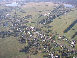
Horní Podluží (German Obergrund) is a village and municipality (obec) in Děčín District in the Ústí nad Labem Region of the Czech Republic.
Map of 407 57 Horn%C3%AD Podlu%C5%BE%C3%AD, Czechia
The municipality covers an area of 7.52 square kilometres (2.90 sq mi), and has a population of 753 (as at 2005).
Horní Podluží lies approximately 29 kilometres (18 mi) north-east of Děčín, 44 km (27 mi) north-east of Ústí nad Labem, and 89 km (55 mi) north of Prague.
References
Horní Podluží Wikipedia(Text) CC BY-SA