
Population 753 (2011) Civil parish Hopton Wafers Local time Tuesday 5:04 PM | OS grid reference SO636765 Dialling code 01299 | |
 | ||
Weather 13°C, Wind W at 18 km/h, 75% Humidity | ||
Hopton Wafers is a small village and civil parish in south Shropshire, England. The population of the public parish at the 2011 census was 753. It is located on the A4117 road to the west of the market town of Cleobury Mortimer.
Map of Hopton Wafers, Kidderminster, UK
Its unusual-sounding name is derived from Old English hop (a side valley running off a larger valley, originally from a Celtic word) and tun (farm or settlement), along with the name of Robert de Wafre, an early holder of the manor.
A post-medieval glassworks was located in Hopton Wafers which produced glass in the 17th and 18th centuries.
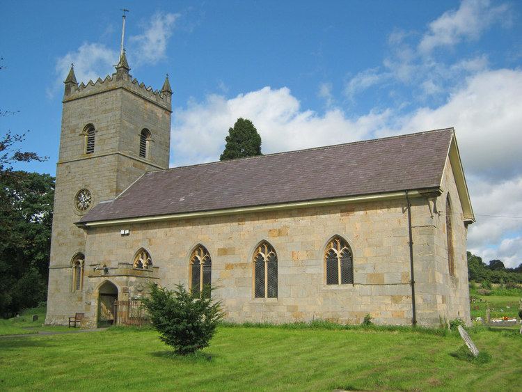
The village church, St Michael and All Angels, was built in 1825: a Norman church had previously stood on the site, but had become dilapidated. The works were funded by Thomas Botfield, who had purchased the manor in 1812.
There is a pub in the village, named The Crown at Hopton.
The county's last remaining emergency escape lane (a sand trap for vehicles unable to brake) was removed in 2014 after being deemed both obsolete and potentially dangerous; it was located at the foot of Hopton Bank (on the A4117).
The 2L bus service (Ludlow-Bewdley-Kidderminster) provides regular public buses Monday to Saturday.