
OS grid reference SO380774 Post town CRAVEN ARMS Local time Tuesday 5:04 PM | Sovereign state United Kingdom Postcode district SY7 Dialling code 01547 | |
 | ||
Weather 13°C, Wind W at 21 km/h, 82% Humidity Civil parishes Clungunford, Hopton Castle, Shropshire | ||
Hopton Heath, or Hoptonheath, is a hamlet in south Shropshire, England. The border with Herefordshire is close by. It lies on the border of the civil parishes of Clungunford and Hopton Castle.
Map of Hoptonheath, Craven Arms, UK
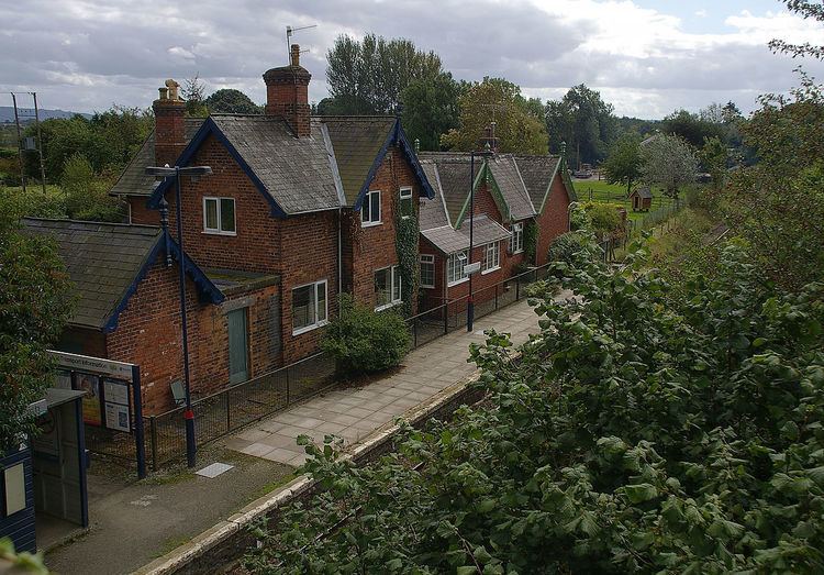
There is a railway station here - Hopton Heath railway station - which today is little more than a halt on the Heart of Wales Line. The hamlet grew as a result of the railway station's construction (in 1861) — it was built to serve the villages of Hopton Castle and Clungunford. Today, a couple of small businesses operate from units near the station and there is also a site of holiday chalets, called "Ashlea Pools".
The B4367 and B4385 roads intersect at Hopton Heath. One mile to the west is the village (and castle) of Hopton Castle, and also nearby are the villages of Bedstone, Clungunford and the hamlets of Beckjay, Broadward, Heath (Herefordshire) and Abcott - with its Rocke Cottage (was Bird on the Rock) tea rooms. The 740 bus service calls at Hopton Heath, with 3 buses a day to Ludlow and Knighton.
There is a Royal Mail post box at the junction of the B roads.