
Local time Tuesday 12:19 PM | ||
 | ||
Weather -1°C, Wind SE at 14 km/h, 60% Humidity | ||
Hopewell Cape is a Canadian village and headland in Albert County, New Brunswick at the northern end of Shepody Bay and the mouth of the Petitcodiac River.
Map of Hopewell Cape, NB, Canada
Located 31 kilometres south of Moncton, Hopewell Cape is the former shire town of Albert County. Exact population figures are not maintained; however, it is among the largest communities in the parish of Hopewell, which had a population in 2001 of 786.
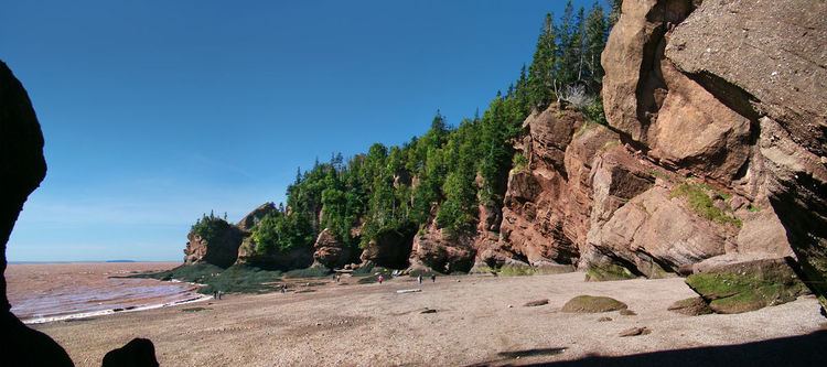
Hopewell Cape is the site of the Hopewell Rocks, a world-famous geological formation accessible at low tide on Shepody Bay. Hopewell Cape is also the site of the Albert County Museum that features an original gaol and courthouse. There are plans for displays at the museum that will highlight the life and career of the Hon. Richard B. Bennett, former Prime Minister of Canada, who was born in nearby Hopewell Hill. Historically, the economy of Hopewell Cape was mainly based on lumbering; today it is largely based on tourism.
On the morning of Mar 14, 2016, Elephant Rock, one of the most photographed of the cliff formations on the shores of the Bay of Fundy, sheared almost in half.