
Country South Africa Area 32.41 km2 Founded 1844 | Language spoken Afrikaans District West Coast | |
 | ||
Hopefield is a settlement in West Coast District Municipality in the Western Cape province of South Africa on the R45 between Malmesbury and Vredenburg.The town is east of Saldanha Bay and Langebaan, 40 km southeast of Vredenburg and 120 km north of Cape Town.
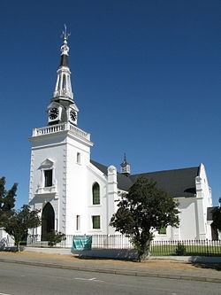
The Dutch Reformed congregation (Zoute Rivier) was established December 1851 and the town was founded in 1852 on the farm Langekuil, it became a municipality in 1914. Named after two people who laid it out, Major William Hope, Auditor-General, and a Mr Field.
The Air Force Base Langebaanweg, 22 km west of the town, as well as the West Coast Fossil park West Coast Fossil park 25km west from town, falls within town limits.
There are two schools in town, Hopefield Primary, presenting Gr 1-7, a fully state sponsored school and Hopefield High, presenting Gr 8-12, a semi-state school with minimal sponsorship from government.
There is an area of the town is called Oudekraalfontein with a population of 5,524 (2011 census).
In earlier years, this now small town, was considered the capital of the West Coast, with banks, filling stations and a multiple other shops and businesses. The only access to the towns of Vredenburg, Langebaan and Saldanha was through Hopefield. With the re-routing of the R45 road, passing the town on the outside and the construction of the R27 (West Coast Road), the infrastructure of the town gradually shrunk away.