Population 105 Sovereign state United Kingdom | OS grid reference TF186140 Post town SPALDING | |
 | ||
UK parliament constituency South Holland and The Deepings | ||
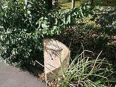
Hop Pole is a small Hamlet in the South Holland district of Lincolnshire, England. It is situated between Deeping St. James and Deeping St. Nicholas, and on the A1175 Littleworth Drove road.
Map of Hop Pole, Spalding, UK
No separate population statistic is available for Hop Pole. The best available report is for the whole Deeping St Nicholas civil parish with a total of 1323 people within 505 dwellings. There are approximately 40 homes in Hop Pole, around 105 people pro rata.
Hop Pole falls within the drainage area of the Welland and Deepings Internal Drainage Board.
References
Hop Pole Wikipedia(Text) CC BY-SA
