
Airport type Military Time zone CST (UTC−6) 16 3,134 Address Fort Hood, TX 76544, USA Owner/operator United States Army | Location Fort Hood, Texas, U.S. Elevation AMSL 924 ft / 282 m 3,134 955 Phone +1 254-553-0501 | |
 | ||
Similar Fort Hood, Skylark Field Airport, City of Killeen, Carl R Darnall Army Me, Clear Creek Gate 3 | ||
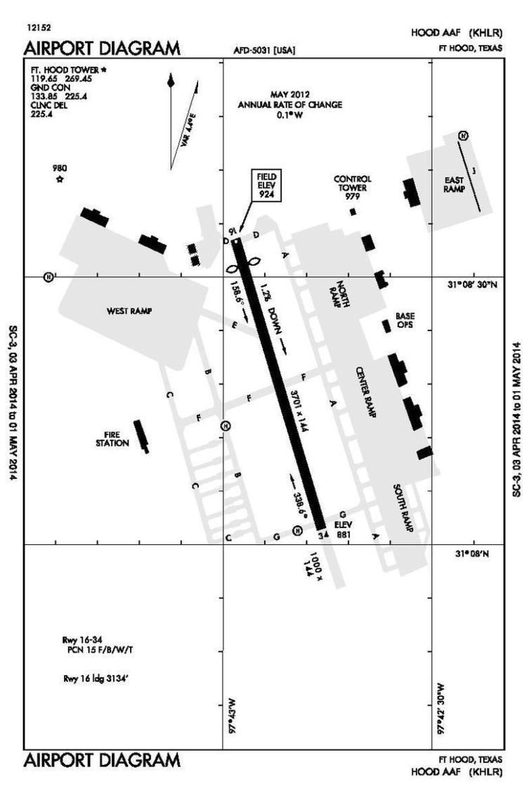
Hood Army Airfield (IATA: HLR, ICAO: KHLR, FAA LID: HLR) is a military airport located at the U.S. Army's Fort Hood, in Killeen, Texas, U.S.
Facilities
Hood Army Airfield has a single 3,701-by-144-foot (1,128 m × 44 m) asphalt runway, identified as 16/34. In the 16 direction, the threshold is displaced by 567 feet (173 m), resulting in a usable length of 3,134 feet (955 m).
The base is also served by Robert Gray Army Airfield (IATA: GRK, ICAO: KGRK, FAA LID: GRK) and two asphalt auxiliary landing strips used for training at North Fort Hood:
References
Hood Army Airfield Wikipedia(Text) CC BY-SA