
- location Church Creek, Maryland - elevation 0 ft (0 m) Country United States of America | - location Hooper's Island Mouth Chesapeake Bay | |
 | ||
- left Wallace Creek, Spicer Creek - right Worlds End Creek, Fox Creek | ||
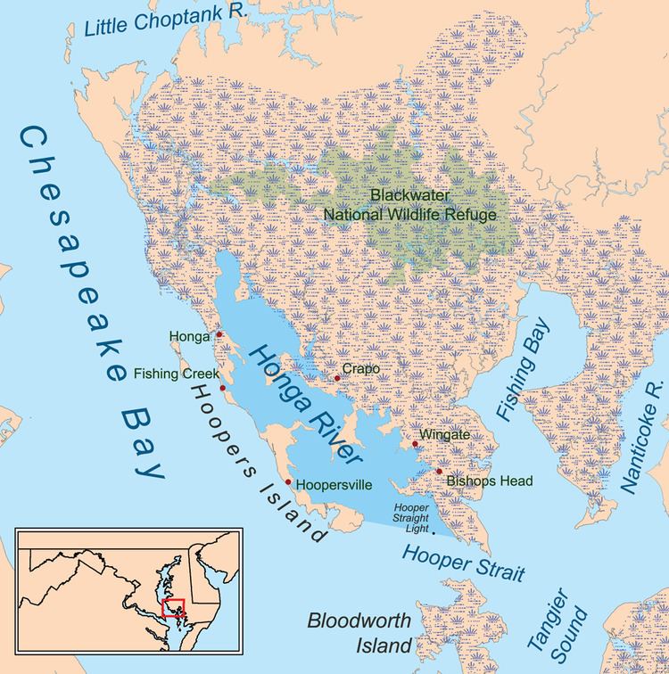
The Honga River is an estuary on the eastern side of the Chesapeake Bay, bounded on the west by Hooper's Island and on the east by the mainland of Dorchester County, Maryland. 14 miles (23 km) in length and over 1 mile (1.6 km) wide, it runs southeast to the west entrance of Hooper Strait, north of Tangier Island; the Hooper Strait Light stood between the two. Towns on the river include Crapo, Fishing Creek and Wingate.
Map of Honga River, Maryland, USA
The river was sometimes called tunger" or even "Hungary" River, Historians hold, however, that the name is derived from the Powatan word kahunge meaning "goose". The Honga was a historic center of the oyster fishery in the bay and continues to be popular with sport fishermen.
References
Honga River Wikipedia(Text) CC BY-SA