
County Marshall Area 93.76 km² Population 151 (2000) | Time zone CST (UTC-6) Zip code 66438 Local time Monday 6:51 PM | |
 | ||
Weather -1°C, Wind N at 18 km/h, 56% Humidity | ||
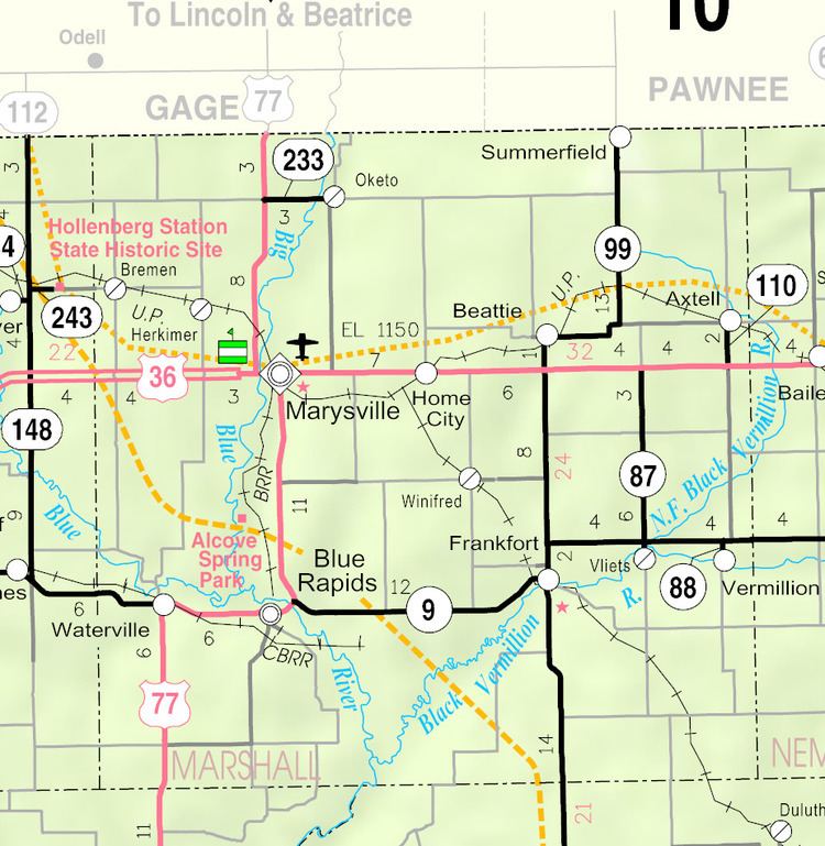
Home (also called Home City) is an unincorporated community and census-designated place in southern Franklin Township, Marshall County, Kansas, United States.
Map of Home, KS 66438, USA
Its altitude is 1,345 feet (410 m), and it is located at 39°50′30″N 96°31′11″W (39.8416678, -96.5197389). Home lies along U.S. Route 36 – the Pony Express Highway – and a Union Pacific rail line, east of the city of Marysville, the county seat of Marshall County.
The town gets its name from the first post office, which was established in 1874 in someone's home. The post office eventually was moved to its own building, which is now facing possible closure due to postal service austerity measures.
References
Home, Kansas Wikipedia(Text) CC BY-SA