
- land 0.68 sq mi (2 km) Area 246 ha | - summer (DST) CDT (UTC-5) Area code 504 | |
 | ||
- water 0.27 sq mi (1 km), 28.42% | ||
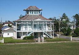
Holy Cross is a neighborhood of the city of New Orleans. A subdistrict of the Lower Ninth Ward District Area, its boundaries as defined by the City Planning Commission are: St. Claude Avenue to the north, St. Bernard Parish to the east, the Mississippi River to the south and the Industrial Canal to the west.
Contents
- Map of Holy Cross New Orleans LA 70117 USA
- Geography
- Adjacent Neighborhoods
- Boundaries
- Demographics
- Holy Cross School
- References
Map of Holy Cross, New Orleans, LA 70117, USA
Geography
Holy Cross is located at 29°57′30″N 90°01′04″W and has an elevation of 3 feet (0.9 m). According to the United States Census Bureau, the district has a total area of 0.95 square miles (2.5 km2). 0.68 square miles (1.8 km2) of which is land and 0.27 square miles (0.7 km2) (28.42%) of which is water.
Adjacent Neighborhoods
Boundaries
The City Planning Commission defines the boundaries of Holy Cross as these streets: St. Claude Avenue, St. Bernard Parish, the Mississippi River and the Industrial Canal.
Demographics
As of the census of 2000, there were 5,507 people, 1,982 households, and 1,315 families residing in the neighborhood. The population density was 8,099 /mi² (3,059 /km²).
As of the census of 2010, there were 2,714 people, 1,040 households, and 642 families residing in the neighborhood.
Holy Cross School
In 1849 the Congregation of the Holy Cross purchased what was once known as Reynes Farm and built St. Isidore’s College, later known as the Holy Cross School, as an all-boys school. The neighborhood soon took its name from the school. The original campus at 4950 Dauphine Street was destroyed by Hurricane Katrina in 2005, forcing the school to relocate to Gentilly. The site now stands abandoned with many redevelopment plans in the works. The Holy Cross Congregation did, however, donate a portion of the campus to the New Orleans Baptist Ministries. The group plans to open a health clinic at the site. The location at the 4900 block of St. Claude Avenue would be the only clinic serving the Lower 9th Ward, and sits on 3.5 acres of land, allowing room for expansion. It would feature both primary and preventative care. Some redevelopment plans are not as supported as the medical clinic plan. The Holy Cross School, in August 2012, sold a portion of the old campus to Perez Architects. Perez plans to build a 180-unit riverfront apartment complex. Opposition from the neighborhood stems from the believed negative impact of the 132 foot building structure on the historic nature of the neighborhood. Supporters of the plan, however, say that the project, which also calls for storefront and restaurant development, will bring money to the area which currently has a 50% population return rate. The Holy Cross Headmaster stated that the school only agreed to sell the land to Perez because they believe that it supported their promise to bring something beneficial to the neighborhood. The building plans now stand before the Historic District Landmark Commission’s architectural review committee. The development would take place in three phases. The first being renovation of the Administration Building, with the building of a farmers’ market and other shops and businesses. The second phase would build the 180-unit apartment building, with 10,000 square feet of space available for restaurants. The third and final phase would include 15,000 square feet of space available for retail and then 130 residential units.