
OS grid reference SD433194 Post town PRESTON | Sovereign state United Kingdom Dialling code 01772 | |
 | ||
Population 5,350 2001 Census (Tarleton Parish) | ||
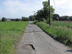
Holmes is a hamlet in West Lancashire, England. It is adjacent to the larger village of Mere Brow, which is between the much larger villages of Banks to the west and Tarleton to the east. It is directly situated on the A565 road, which gives the village good links with Preston, Southport and Liverpool. Historically, the village was an agricultural settlement, due to the excellent soil, and farming is still important.
Map of Holmes, Preston, UK
The hamlet is administered by West Lancashire District Council and Tarleton parish council. Holmes and neighbouring Mere Brow were part of the ancient parish of North Meols but now are part of Tarleton parish.
Holmes has a small church. The main business is Huntapac, a farming company that grows and supplies vegetables to supermarkets.