
OS grid reference SO560895 Post town MUCH WENLOCK Local time Monday 11:30 AM Civil parish Abdon | Sovereign state United Kingdom Postcode district TF13 Dialling code 01746 | |
 | ||
Weather 11°C, Wind W at 19 km/h, 74% Humidity | ||
Holdgate (or Stanton Holdgate or Castle Holdgate) is a small village in Shropshire, England. It forms part of the civil parish of Abdon. Its name is taken from its Norman lord Helgot who owned the village in 1086 along with 17 other parishes in Shropshire.
Map of Holdgate, Much Wenlock, UK
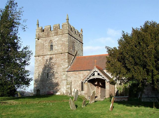
The village is laid on top of a small hill which rises to 169 metres (554 ft) above sea level. Its parish church is Holy Trinity. There are remnants of the medieval Holdgate Castle. Holdgate was once (in medieval times) a more populous place than today.
Holdgate was a civil parish until 1967. Bouldon was, until 1884, a detached part of Holdgate parish.
A mile (1.6 km) to the northeast is the village of Stanton Long. Between the two villages, but within the former Holdgate parish (now in the Abdon parish) is the hamlet of Brookhampton.
To the south is Tugford.