
Population 2,180 (2011) District Babergh | Sovereign state United Kingdom Postcode district IP9 2 Local time Monday 9:47 AM | |
 | ||
Weather 10°C, Wind NW at 18 km/h, 74% Humidity | ||
Holbrook is a village situated close to the northern shore of the Stour estuary in Suffolk, England. It is located on the Shotley peninsula in Babergh district, around 5 miles (8.0 km) south of Ipswich.
Contents
Map of Holbrook, UK
To the south of the village is the Royal Hospital School, which moved to this site in 1933 after having been housed at Greenwich Hospital since 1693.
Lower Holbrook is a hamlet between the villages of Holbrook and Harkstead.
Governance
An electoral ward of the same name exists. The population of this ward at the 2011 census was 2,467.
Facilities
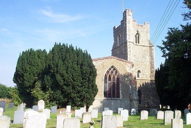
The village has two pubs, the Compasses and the Swan, a Co-op store, a newsagent, a hairdresser and a village hall. The area is served by a primary school and Holbrook Academy, which shares a site with the Peninsula Sports Centre. The parish church is dedicated to All Saints. The village also has Methodist church.
History
During the Battle of Britain, a German military aircraft crashed into a field near the village. Contemporary newspaper accounts identified the aircraft as a Messerschmitt.