
Time zone CET/CEST (UTC+1/+2) Postal code 15344 Dialling code 03341 | Elevation 94 m (308 ft) Postal codes 15344 | |
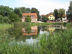 | ||
Hohenstein is a village and a civil parish (Ortsteil) of the German town of Strausberg, located in the district of Märkisch-Oderland in Brandenburg. As of 2007 its population was of 233.
Contents
Map of Hohenstein, Strausberg, Germany
History
The village was first mentioned in 1375 with the name of Hohensten.
Geography
Hohenstein is situated in the east of Strausberg, on a road linking the town and Buckow, close to Ruhlsdorf and to the western entrance to the Märkische Schweiz Nature Park. It is also connected with the nearby village of Gladowshöhe by a road that links Rehfelde and Garzau-Garzin with Klosterdorf.
References
Hohenstein (Strausberg) Wikipedia(Text) CC BY-SA