
Country United States County New Castle Time zone Eastern (EST) (UTC-5) Area 25.9 km² | Elevation 259 ft (79 m) ZIP code 19707 Population 13,527 (2010) | |
 | ||
Neighborhoods Westgate Farms, Delaware, Hockessin Park | ||
Hockessin delaware
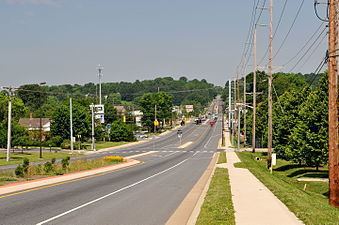
Hockessin /ˈhoʊkɛsᵻn/ is a census-designated place (CDP) in New Castle County, Delaware, United States. The population was 13,527 at the 2010 census. The place name may be derived from the Lenape word "hòkèsa" meaning "pieces of bark" or from a misspelling of "occasion," as pronounced by the Quakers who settled the area originally.
Contents
- Hockessin delaware
- Map of Hockessin DE USA
- Geography
- Demographics
- Industry
- Notable residents
- History
- Education
- Annual events
- Portrayal in the media
- References
Map of Hockessin, DE, USA
Geography
Hockessin is located at 39°47′15″N 75°41′48″W (39.7876112, -75.6966001).
According to the United States Census Bureau, the CDP has a total area of 10.0 square miles (26 km2), of which, 10.0 square miles (26 km2) of it is land and 0.10% is water.
Demographics
As of the census of 2000, there were 12,902 people, 4,464 households, and 3,731 families residing in the CDP. The population density was 1,286.7 people per square mile (496.7/km²). There were 4,575 housing units at an average density of 456.3 per square mile (176.1/km²). The racial makeup of the CDP was 88.82% White, 2.65% African American, 0.07% Native American, 7.16% Asian, 0.01% Pacific Islander, 0.45% from other races, and 0.84% from two or more races. Hispanic or Latino of any race were 1.99% of the population. From 1990 to 2016, the population of Hockessin has grown by about 35%.
There were 4,464 households out of which 40.1% had children under the age of 18 living with them, 77.3% were married couples living together, 4.5% had a female householder with no husband present, and 16.4% were non-families. 13.9% of all households were made up of individuals and 8.9% had someone living alone who was 65 years of age or older. The average household size was 2.83 and the average family size was 3.13.
In the CDP, the population was spread out with 26.9% under the age of 18, 4.7% from 18 to 24, 24.5% from 25 to 44, 28.7% from 45 to 64, and 15.3% who were 65 years of age or older. The median age was 42 years. For every 100 females there were 95.6 males. For every 100 females age 18 and over, there were 91.9 males.
The median income for a household in the CDP was $100,844, and the median income for a family was $108,784. Males had a median income of $76,617 versus $46,988 for females. The per capita income for the CDP was $40,516. About 1.0% of families and 1.7% of the population were below the poverty line, including 2.0% of those under age 18 and 1.3% of those age 65 or over.
Industry
Although Hockessin is primarily a bedroom community, there are several mushroom farms operating in the area.
Notable residents
History
Hockessin traces its roots to 1688.
The first Roman Catholic church in Delaware was located in Hockessin. Missionary priests from Maryland established the Coffee Run Mission in 1790.
The A. Armstrong Farm, Coffee Run Mission Site, Hockessin Friends Meetinghouse, T. Pierson Farm, Public School No. 29, Springer Farm, and Wilmington and Western Railroad are listed on the National Register of Historic Places in 1978.
Education
Annual events
Hockessin hosts several Fourth of July activities for the area residents. Local groups parade down Old Lancaster Pike, neighborhoods compete in different athletic events, and there is a fireworks display in the evening in Swift Park.