
Country United States FIPS code 53-31495 Elevation 173 m Population 6,221 (2010) | Time zone Pacific (PST) (UTC-8) GNIS feature ID 1520825 Zip code 98025 Area code 425 | |
 | ||
Area 48.69 km² (48.43 km² Land / 26 ha Water) Neighborhoods Dorre Don, Cedar Grove, Noble, Arcadia, Atkinson, Orchard Grove, Tahoma, Landsburg | ||
Hobart is a census-designated place (CDP) in King County, Washington, United States. The population was 6,221 at the 2010 census.
Contents
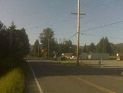
Map of Hobart, WA, USA
Based on per capita income, one of the more reliable measures of affluence, Hobart ranks 31st of 522 areas in the state of Washington to be ranked.
Geography
Hobart is located at 47°24′56″N 122°0′21″W (47.415568, -122.005950).
According to the United States Census Bureau, the CDP has a total area of 18.8 square miles (48.6 km²), of which, 18.7 square miles (48.3 km²) of it is land and 0.1 square miles (0.3 km²) of it (0.59%) is water.
The town of Hobart was named in honor of Garret Augustus Hobart (June 3, 1844 – November 21, 1899) the 24th Vice President of the United States.
Climate
This region experiences warm (but not hot) and dry summers, with no average monthly temperatures above 71.6 °F. According to the Köppen Climate Classification system, Hobart has a warm-summer Mediterranean climate, abbreviated "Csb" on climate maps.
Demographics
As of the census of 2000, there were 6,251 people, 2,200 households, and 1,766 families residing in the CDP. The population density was 335.0 people per square mile (129.3/km²). There were 2,263 housing units at an average density of 121.3/sq mi (46.8/km²). The racial makeup of the CDP was 95.10% White, 0.82% African American, 0.67% Native American, 0.91% Asian, 0.13% Pacific Islander, 0.40% from other races, and 1.97% from two or more races. Hispanic or Latino of any race were 1.62% of the population.
There were 2,200 households out of which 37.5% had children under the age of 18 living with them, 71.3% were married couples living together, 4.9% had a female householder with no husband present, and 19.7% were non-families. 14.7% of all households were made up of individuals and 4.4% had someone living alone who was 65 years of age or older. The average household size was 2.84 and the average family size was 3.15.
In the CDP the population was spread out with 27.2% under the age of 18, 6.2% from 18 to 24, 28.1% from 25 to 44, 30.4% from 45 to 64, and 8.1% who were 65 years of age or older. The median age was 40 years. For every 100 females there were 105.3 males. For every 100 females age 18 and over, there were 105.6 males.
The median income for a household in the CDP was $75,334, and the median income for a family was $80,127. Males had a median income of $53,942 versus $40,433 for females. The per capita income for the CDP was $32,067. About 1.4% of families and 2.3% of the population were below the poverty line, including 0.8% of those under age 18 and 4.9% of those age 65 or over.