
Country United States County Columbia FIPS code 36-34748 Elevation 293 m Population 1,927 (2010) Area code 518 | State New York Time zone Eastern (EST) (UTC-5) GNIS feature ID 0979068 Zip code 12529 Local time Saturday 2:25 PM | |
 | ||
Weather -8°C, Wind W at 39 km/h, 41% Humidity Area 124.1 km² (123.5 km² Land / 52 ha Water) | ||
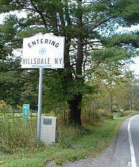
Hillsdale is a tiny town north of Copake, New York. Route 22 and 23 intersect in the town square, which has a pizza restaurant and a pharmacy. It is known for its hilly landscape and it is just several minutes away from Bash Bish Falls and Taconic State Park.
Contents
- Map of Hillsdale NY 12529 USA
- History
- Geography
- Demographics
- Communities and locations in Hillsdale
- Festivals and celebrations
- Notable people
- References
Map of Hillsdale, NY 12529, USA
History
The region was taken from the town of Claverack in 1782. The town of Hillsdale was established in 1788.
In 1776 Henry Knox passed through Hillsdale while transporting cannons from Albany, New York, to aid the siege of Boston. There are two markers in Hillsdale along the Henry Knox Trail.
The Dr. Joseph P. Dorr House and Pine View Farm are listed on the National Register of Historic Places.
Geography
According to the United States Census Bureau, the town has a total area of 47.9 square miles (124.0 km2), of which 47.7 square miles (123.6 km2) is land and 0.15 square miles (0.4 km2), or 0.34%, is water.
The east town line is the New York – Massachusetts border.
Demographics
As of the census of 2000, there were 1,744 people, 721 households, and 485 families residing in the town. The population density was 36.6 people per square mile (14.1/km²). There were 1,133 housing units at an average density of 23.8 per square mile (9.2/km²). The racial makeup of the town was 97.88% White, 0.63% African American, 0.46% Asian, 0.52% from other races, and 0.52% from two or more races. Hispanic or Latino of any race were 1.61% of the population.
There were 721 households out of which 28.4% had children under the age of 18 living with them, 54.0% were married couples living together, 7.6% had a female householder with no husband present, and 32.6% were non-families. 25.7% of all households were made up of individuals and 10.7% had someone living alone who was 65 years of age or older. The average household size was 2.42 and the average family size was 2.90.
In the town, the population was spread out with 23.9% under the age of 18, 5.9% from 18 to 24, 23.1% from 25 to 44, 30.2% from 45 to 64, and 17.0% who were 65 years of age or older. The median age was 43 years. For every 100 females there were 98.9 males. For every 100 females age 18 and over, there were 97.5 males.
The median income for a household in the town was $40,156, and the median income for a family was $46,250. Males had a median income of $30,893 versus $25,694 for females. The per capita income for the town was $27,186. About 4.7% of families and 8.3% of the population were below the poverty line, including 8.5% of those under age 18 and 5.1% of those age 65 or over.