
States North Rhine-Westphalia | Country Germany | |
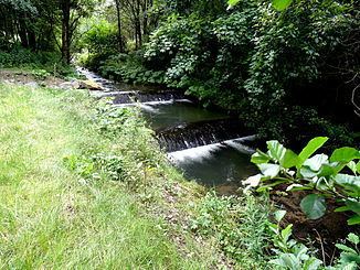 | ||
Hillebach is a river of North Rhine-Westphalia, Germany.
Map of Hille, Germany
The Hillebachstausee rises in the Natural Park Sauerland Rothaargebirge about 1 km south of the border to the north-west part of Hessen and the local Upland. Its source is on the southeast edge of the 804.9 m high Hille head that rises north of Küstelberg, a west-north-west of the town of Medebach. It is located in the district Küstelberg to approximately 692.5 m. East above the source leads at a location at 693.5 meters above sea level path Telle past the Rothaarsteig.
The brook flows - by source-level leaving the Natural Park Sauerland Rothaar - in predominantly north-westerly direction. Then it flows - after right-sided open out the zoom flowing also from Hillekopf welding Micke - Hildfeld, a northern district of Winterberg, near the southern outskirts. Southwest of the village opens a referred to in underflow Grone Springebach who comes from the south towards the town of Grönenbach. Then happened the stream to about 837 m high mountain Clemens, the highest and dominant mountain at cup-shaped river valley, and located on the lower part of its western flank cottages.
Shortly thereafter flows through the Hillebachstausee the lying below the Rimberg (764.5 m) Hillestausee at low altitudes, a northern district of Winterberg, a few hundred meters distance downstream - west of the village hall (Schützenhalle) - at about 519 m altitude there coming in from the south Rhein-Ruhr tributary to open.