Former municipality Scarborough | ||
 | ||
Changed Municipality 1998 Toronto from Scarborough Restaurants Toronto Pan Am Sports Ce, Highland Fish & Chips, Fratelli Village Pizzeria, Ted's Restaurant, Sofis Mexican Bar and | ||
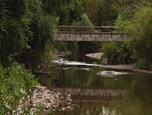
Highland Creek is a neighbourhood in eastern Toronto, Ontario, Canada. It is located along the southern portion of the river of the same name in the former suburb of Scarborough. To the east are the neighbourhoods of Port Union and West Rouge, to the west West Hill and Woburn, and to the south Centennial Scarborough.
Contents
Map of Highland Creek, Toronto, ON, Canada
The western portion of the neighbourhood is occupied by the University of Toronto Scarborough, a feature landmark in the area and a busy pedestrian centre.
History
Like many creeks and river valleys in Toronto, evidence of First Nations occupation has been found in this area. A 2005 excavation by the Toronto and Region Conservation Authority near the mouth of Highland Creek found evidence of a Late Woodland or Early Archaic site, thought to have been a place of tool manufacture. The Helliwell family, one of the first settlers in the area, accumulated a large number of artifacts from the last 5,000 years.
The Highland Creek area was one of the first areas to be occupied by European settlers in the area of what would later become the Township of Scarborough. This is mainly due to the presence of Highland Creek, the river that runs through the neighbourhood, whose valley is occupied by large trees and wildlife. During the 18th and early-19th centuries, the area was home to vast farmlands and homes. In 1954, Hurricane Hazel destroyed many dwellings in the area and contributed to the flooding of the creek.
In 1963, the University of Toronto purchased the western part of the land from E. L. MacLean, who acquired the land from its original owner Miller Lash, a businessman from Old Toronto who built an estate on the land, now known as the Miller Lash House, in 1911. The university eventually built and opened the Scarborough College, which is today known as University of Toronto Scarborough, a satellite campus of the university.
Transportation
As it is located along Old Kingston Road, which was a former provincial highway that connected Toronto and Kingston, Ontario, it is home to some of the oldest buildings in Scarborough. Highway 2A runs just south of the neighbourhood's core.
Toronto Transit Commission (TTC) bus route 38 is named after the neighbourhood and runs 7 days a week, between Scarborough Centre station and the Rouge Hill GO Station, along Ellesmere Road, Military Trail, Lawson Road, and Port Union Road. 54 Lawrence East, 85 Sheppard East, 86 Scarborough, 95 York Mills, and 116A/116E Morningside also serve parts of the neighbourhood. GO Transit coach route 51 and Durham Region Transit routes 900 and 923 stop at the University of Toronto Scarborough.
Landmarks
The University of Toronto Scarborough and Colonel Danforth Park are in the community. The community is one of the most prestigious neighbourhoods in Scarborough with wide lot homes. Home prices are relatively expensive compared to other areas of Scarborough. This partly due to the location of the university.
After the opening of the college, the neighbourhood was developed primarily into residential areas. Areas dominated by wildlife, which is located along the Highland Creek valley, were left alone. Some shops and a church exist along the commercial Old Kingston Road.
