
Country Japan District Shimokita Area 295.3 km² Local time Saturday 2:03 PM Prefecture Aomori Prefecture | Region Tōhoku Phone number 0175-27-2111 Population 6,725 (28 Feb 2017) Bird Slaty-backed gull | |
 | ||
Time zone Japan Standard Time (UTC+9) Address 5-34 Isogomata Sawanai,Higashidōri-mura, Shimokita-gun, Aomori-ken 039-4292 Weather 5°C, Wind NW at 14 km/h, 57% Humidity Points of interest Shiriyazaki Lighthouse, Sarugamori Sand Dunes, Kuwahatayama | ||
Higashidōri (東通村, Higashidōri-mura) is a village located in Shimokita District of northeastern Aomori Prefecture in the Tōhoku region of northern Japan. As of 28 February 2017, the village had an estimated population of 6,725 and a population density of 22.8 persons per km2 in 2822 households. Its total area was 295.27 square kilometres (114.00 sq mi).
Contents
- Map of Higashidori Shimokita District Aomori Prefecture Japan
- Geography
- Neighbouring municipalities
- Demographics
- History
- Education
- Economy
- Railway
- Highway
- Local attractions
- References
Map of Higashidori, Shimokita District, Aomori Prefecture, Japan
Geography
Higashidōri occupies the northeastern coastline of Shimokita Peninsula, facing the Pacific Ocean to the east and Tsugaru Strait to the north, with Cape Shiriyazaki forming a boundary between the two waters. The village has a cold Humid continental climate characterized by cool short summers and long cold winters with heavy snowfall (Köppen climate classification Dfb). The average annual temperature in Higashidōri is 8.6 °C. The average annual rainfall is 1268 mm with September as the wettest month.The temperatures are highest on average in August, at around 21.4 °C, and lowest in January, at around -3.0 °C.
Parts of the village are within the limits of the Shimokita Hantō Quasi-National Park. In the year 2002, the Ministry of the Enviroment classified some tidal flats of the Higashidōri shoreline to be one of the 500 Important Wetlands in Japan and an important wintering place for Brent geese
Neighbouring municipalities
Demographics
Per Japanese census data, the population of Higashidōri has declined over the past 40 years.
History
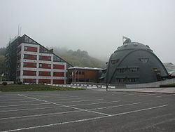
The area around Higashidōri was inhabited by the Emishi people, with archaeological remains dating to the Jōmon period. During the Edo period, it was controlled by the Nambu clan of Morioka Domain, but was a sparsely populated area with scattered fishing hamlets. During the cadastral reform of 1889, Higashidōri Village was proclaimed from the merger of twelve small hamlets, although the village administrative center was kept within the town hall of neighboring Tanabu Town (now part of the city of Mutsu). In 1988, to celebrate its 100th anniversary as a village, a village hall was finally built within the borders of Higashidōri.
Education
Higashidōri has one public elementary school and one public middle schools operated by the town government. The village does not have a high school.
Economy
The economy of Higashidōri was traditionally almost completely dependent on commercial fishing. However, since the 1980s, there has been massive investment from Tōhoku Electric Power Company and Tokyo Electric Power Company towards the construction of the Higashidōri Nuclear Power Plant and related support facilities. In addition, the Iwaya Wind Farm, with a total generation capacity of 32.5 MW, is the largest in Japan.