Width 430 m (1,410 ft) Highest elevation 34 m (112 ft) Area 50 ha | Length 1.4 km (0.87 mi) Coastline 4 km (2.5 mi) County Hordaland Municipality Øygarden | |
 | ||
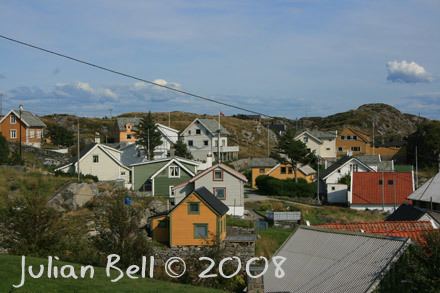
Hernar is an island in Øygarden municipality in Hordaland county, Norway. It is one of the northernmost islands in the Øygarden archipelago. The 0.5-square-kilometre (120-acre) island is rocky and barren. Most of the settlement is in one cluster on the southwestern part of the island along the small harbor area. The eastern third of the island is uninhabited.
Map of Hernar, 5335 Hernar, Norway
It sits in a cluster of mostly uninhabited islands, about 3.5 kilometres (2.2 mi) north of the island of Seløyna, the northernmost large, populated island in Øygarden which is connected to the mainland by a series of bridges. Hernar has about 15 permanent inhabitants and many holiday cabins. It is connected to the mainland via a passenger ferry service to the small island of Hellesøyna, just off the coast of Seløyna. The ferry service is operated by Bergen Nordhordland Rutelag.
