
District Žďár nad Sázavou Elevation 642 m Local time Friday 4:47 PM | Postal code 592 01 Area 23.85 km² | |
 | ||
Weather 2°C, Wind NW at 24 km/h, 98% Humidity Points of interest Pilgrimage Church of Saint Joh, Velké Dářko, Pohádková vesnička Podlesíčko, Devět skal, Čtyři palice | ||
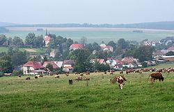
Herálec is a village and municipality (obec) in Žďár nad Sázavou District in the Vysočina Region of the Czech Republic.
Map of Her%C3%A1lec, Czechia
The municipality covers an area of 23.85 square kilometres (9.21 sq mi), and has a population of 1,239 (as at 28 August 2006).
Herálec lies approximately 15 kilometres (9 mi) north of Žďár nad Sázavou, 44 km (27 mi) north-east of Jihlava, and 122 km (76 mi) east of Prague.
References
Herálec (Žďár nad Sázavou District) Wikipedia(Text) CC BY-SA