
 | ||
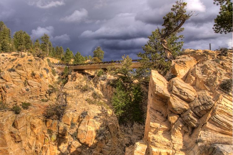
Hell's Backbone Road is a 38-mile (61 km) gravel road that was built by the Civilian Conservation Corps in the 1930s, and connects the towns of Boulder, Utah and Escalante, Utah. Halfway along the road is Hell's Backbone Bridge, which is 109 feet (33 m) long, and 14 feet (4.3 m) wide. A 1,500-foot (460 m) drop is on either side. Near the bridge are spectacular views of the Box-Death Hollow Wilderness. From late spring to autumn, the road, which climbs to more than 9,000 feet (2,750 m) elevation, is easily passable by ordinary passenger vehicles, but it is very narrow and winding, and not for the faint of heart.
Map of Hells Backbone Rd, Utah, USA
Hell's Backbone Road is a high-country alternative to the paved Utah Scenic Byway 12, which also connects Boulder and Escalante, 27 road miles (44 km) apart.