
Elevation 353 m | Postal code 582 82 Area 4.54 km² | |
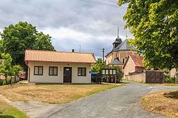 | ||
Heřmanice is a village and municipality (obec) in Havlíčkův Brod District in the Vysočina Region of the Czech Republic.
Map of 582 82 He%C5%99manice, Czechia
The municipality covers an area of 4.54 square kilometres (1.75 sq mi), and has a population of 69 (as at 28 August 2006).
Heřmanice lies approximately 25 kilometres (16 mi) north of Havlíčkův Brod, 48 km (30 mi) north of Jihlava, and 87 km (54 mi) east of Prague.
References
Heřmanice (Havlíčkův Brod District) Wikipedia(Text) CC BY-SA