
Country United States Area code(s) 573 Elevation 82 m Population 2,849 (2013) | Time zone Central (CST) (UTC-6) FIPS code 29-31132 Zip code 63851 Local time Saturday 7:14 AM | |
 | ||
Weather 11°C, Wind N at 13 km/h, 83% Humidity | ||
270 missioncast what happened in hayti missouri
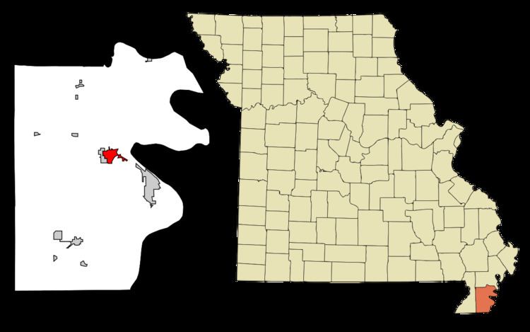
Hayti (pronounced "HAY-tie") is a city in Pemiscot County, Missouri, United States. The population was 2,939 at the 2010 census.
Contents
- 270 missioncast what happened in hayti missouri
- Map of Hayti MO 63851 USA
- History
- Geography
- 2010 census
- 2000 census
- Notable people
- References
Map of Hayti, MO 63851, USA
History
Hayti was platted in 1894, when the railroad was extended to that point. According to one tradition, the name honors Dr. G. Hayes, an original owner of the site. It is also claimed the name is derived from the country of Haiti. A post office called Hayti has been in operation since 1895.
Geography
Hayti is located at 36°14′1″N 89°44′55″W (36.233526, -89.748578).
According to the United States Census Bureau, the city has a total area of 2.31 square miles (5.98 km2), of which 2.30 square miles (5.96 km2) is land and 0.01 square miles (0.03 km2) is water.
Hayti is located north of the junction of Interstate 55 and U.S. Route 412
2010 census
As of the census of 2010, there were 2,939 people, 1,258 households, and 739 families residing in the city. The population density was 1,277.8 inhabitants per square mile (493.4/km2). There were 1,376 housing units at an average density of 598.3 per square mile (231.0/km2). The racial makeup of the city was 52.23% White, 45.12% Black or African American, 0.31% Native American, 0.31% Asian, 0.51% from other races, and 1.53% from two or more races. Hispanic or Latino of any race were 0.99% of the population.
There were 1,258 households of which 31.2% had children under the age of 18 living with them, 28.1% were married couples living together, 25.4% had a female householder with no husband present, 5.3% had a male householder with no wife present, and 41.3% were non-families. 36.6% of all households were made up of individuals and 15.7% had someone living alone who was 65 years of age or older. The average household size was 2.30 and the average family size was 3.01.
The median age in the city was 38.2 years. 26.9% of residents were under the age of 18; 9.9% were between the ages of 18 and 24; 21.6% were from 25 to 44; 25.3% were from 45 to 64; and 16.4% were 65 years of age or older. The gender makeup of the city was 45.8% male and 54.2% female.
2000 census
As of the census of 2000, there were 3,207 people, 1,318 households, and 809 families residing in the city. The population density was 1,450.1 people per square mile (560.3/km²). There were 1,436 housing units at an average density of 649.3 per square mile (250.9/km²). The racial makeup of the city was 54.66% White, 43.75% African American, 0.44% Native American, 0.19% Asian, 0.12% from other races, and 0.84% from two or more races. Hispanic or Latino of any race were 1.31% of the population.
There were 1,318 households out of which 30.1% had children under the age of 18 living with them, 33.8% were married couples living together, 23.9% had a female householder with no husband present, and 38.6% were non-families. 36.1% of all households were made up of individuals and 19.2% had someone living alone who was 65 years of age or older. The average household size was 2.33 and the average family size was 3.06.
In the city, the population was spread out with 30.1% under the age of 18, 8.0% from 18 to 24, 23.3% from 25 to 44, 19.4% from 45 to 64, and 19.3% who were 65 years of age or older. The median age was 35 years. For every 100 females there were 79.9 males. For every 100 females age 18 and over, there were 73.0 males.
The median income for a household in the city was $15,384, and the median income for a family was $23,720. Males had a median income of $24,028 versus $15,486 for females. The per capita income for the city was $13,265. About 35.7% of families and 38.3% of the population were below the poverty line, including 54.7% of those under age 18 and 29.5% of those age 65 or over.