
Country United States Time zone Pacific (PST) (UTC-8) GNIS feature ID 0848558 Elevation 1,320 m Population 3,269 (2010) Area code Area code 775 | FIPS code 32-31300 Reference no. 60 Area 3.8 km² Zip code 89415 | |
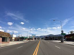 | ||
Hawthorne is a census-designated place (CDP) in Mineral County, Nevada, United States. At the 2010 census, the population was 3,269, a decrease since the 2000 census, when it was 3,311. It is the county seat of Mineral County. The nearby Hawthorne Army Depot is the primary economic base of the town.
Contents
Map of Hawthorne, NV 89415, USA
Geography
Hawthorne is located at 38°31′31″N 118°37′23″W (38.525198, -118.623053).
According to the United States Census Bureau, the CDP has a total area of 1.5 square miles (3.9 km2), all of it land.
It sits between Lake Walker, Babbitt and under the peak of Mt. Grant, and its summit of 11,239 feet (3,426 m).
Demographics
At the 2010 census, the population was 3,269.
As of the census of 2000, there were 3,311 people, 1,465 households, and 937 families residing in the CDP. The population density was 2,234.9 people per square mile (863.8/km²). There were 1,883 housing units at an average density of 1,271.0 per square mile (491.2/km²). The racial makeup of the CDP was 84.48% White, 0.016% African American, 2.81% Native American, 1.21% Asian, 0.12% Pacific Islander, 3.05% from other races, and 2.17% from two or more races. Hispanic or Latino of any race were 9.09% of the population.
There were 1,465 households out of which 24.9% had children under the age of 18 living with them, 46.4% were married couples living together, 11.2% had a female householder with no husband present, and 36.0% were non-families. 31.2% of all households were made up of individuals and 15.2% had someone living alone who was 65 years of age or older. The average household size was 2.25 and the average family size was 2.74.
In the CDP, the population was spread out with 22.9% under the age of 18, 6.6% from 18 to 24, 22.3% from 25 to 44, 27.5% from 45 to 64, and 20.6% who were 65 years of age or older. The median age was 44 years. For every 100 females there were 97.8 males. For every 100 females age 18 and over, there were 96.2 males.
The median income for a household in the CDP was $34,413, and the median income for a family was $41,733. Males had a median income of $31,344 versus $25,058 for females. The per capita income for the CDP was $17,830. About 8.6% of families and 10.8% of the population were below the poverty line, including 14.7% of those under age 18 and 8.0% of those age 65 or over.
History
One of Hawthorne's official websites, [1] tells us, "In 1880 H.M. Yerington, the president of the Carson and Colorado Railroad Co., selected Hawthorne as a townsite. In 1883 Hawthorne, was named the Esmeralda County seat. The town later lost that distinction, but in 1911 became the county seat for Mineral County." [2]