
Territory Puerto Rico Local time Friday 9:36 PM | Population 20,867 (2000) Municipality San Juan | |
 | ||
Weather 26°C, Wind NE at 19 km/h, 76% Humidity Area 2.694 km² (2.668 km² Land / 3 ha Water) Colleges and Universities Polytechnic University of Puerto, Liceo de Arte y Tecnologia, Escuela Hotelera de San J | ||
With a population density of 20,320.7 per square mile (7,845.87/km2), Hato Rey Central is the most densely populated barrio in the municipality of San Juan, Puerto Rico. It has a land area of 1.03 sq mi (2.67 km2) and a 2000 Census population of 20,867.
Contents
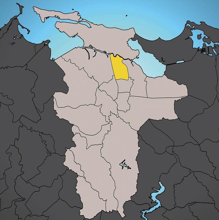
Map of Hato Rey Central, San Juan, Puerto Rico
Hato Rey Central was part of the former municipality of Rio Piedras, before it was merged with San Juan in 1951.
It is bounded by Hato Rey Norte to the west, by barrio Universidad to the south, by Oriente to the east, and by Santurce to the north. The Caño Martín Peña separates Hato Rey Central from Santurce.
The Polytechnic University of Puerto Rico is located in Hato Rey Central.
Districts
The barrio of Hato Rey Central is further subdivided into four “subarrios” or sectores.
References
Hato Rey Central, San Juan, Puerto Rico Wikipedia(Text) CC BY-SA