
Official name Presa Hatillo Status Operational | Construction began 1977 | |
 | ||
Purpose Power, irrigation, flood control Opening date 1984; 33 years ago (1984) Similar Los Haitises National, Pico Duarte, Samaná Bay, Lake Enriquillo, Punta Espada Golf Cour | ||
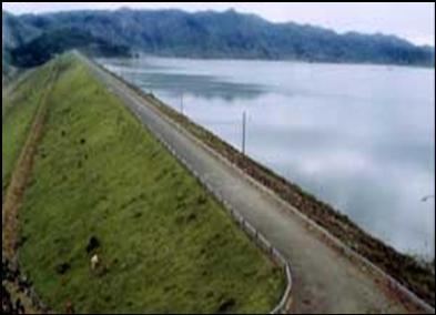
The Hatillo Dam is an earth and rock-filled embankment dam on the Yuna River about 6 km (3.7 mi) southwest of Cotuí in Sánchez Ramírez Province of the Dominican Republic. With a storage capacity of 710,000,000 m3 (580,000 acre·ft), the dam's reservoir is the largest in the country. The purpose of the dam is to produce hydroelectric power, provide water for irrigation and to control floods. The power station is located at the base of the dam and contains a single 8 MW Francis turbine-generator. Construction on the dam began in August 1977 and it was completed in 1984.
Map of Hatillo Dam, 43000, Dominican Republic
References
Hatillo Dam Wikipedia(Text) CC BY-SA