
Country United States County Barry ZIP code 49058 Elevation 246 m Population 7,304 (2013) | Time zone Eastern (EST) (UTC-5) Area code(s) 269 Area 13.68 km² Local time Friday 7:11 PM | |
 | ||
Weather 1°C, Wind S at 16 km/h, 95% Humidity | ||
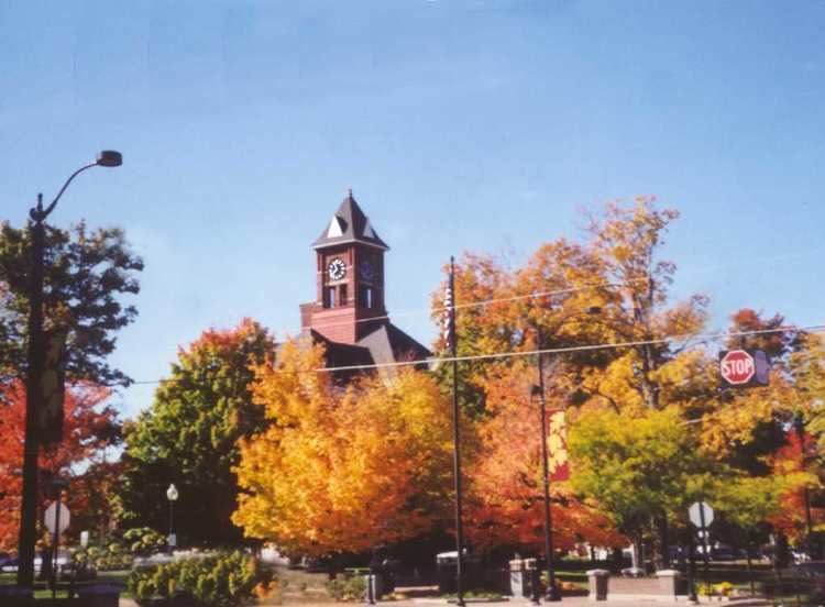
Hastings is a city in the U.S. state of Michigan, the county seat of Barry County as well as the county's only city. The population was 7,350 at the 2010 census. The city borders Hastings Charter Township on the north, east, and south, and Rutland Charter Township on the west.
Contents
- Map of Hastings MI 49058 USA
- History
- Geography
- Climate
- 2010 census
- 2000 census
- Arts and culture
- Hastings School District
- Private Schools
- Community College
- Major highways
- Public library
- Notable people
- References
Map of Hastings, MI 49058, USA
Hastings is part of the Grand Rapids-Wyoming metropolitan area.
History
In 1836 three entrepreneurs named Dibble, Kingsbury and Kendall bought 480 acres (1.9 km2) along the Thornapple River from Detroit banker Eurotas P. Hastings. The three platted the area into lots, and soon a small community arose. In 1843, the state legislature designated Hastings as the County Seat of Barry County. The first paper, the Barry County Pioneer, began publishing in 1851, and a second paper, the Republican Banner, began in 1856. The latter publication, a weekly paper published on Thursdays, continues to be published as the Hastings Banner.
Hastings was incorporated as a village in 1855, with a population of around 300, and on March 11, 1871, Hastings officially became a city. The Barry County Courthouse, which is still in use today, was built in 1893. The city grew slowly, reaching 6,500 people in 1960 and remaining nearly flat through 1990.
Geography
According to the United States Census Bureau, the city has a total area of 5.28 square miles (13.68 km2), of which 5.20 square miles (13.47 km2) is land and 0.08 square miles (0.21 km2) is water. The Thornapple River passes through the city from east to west.
Climate
The Köppen Climate Classification subtype for this climate is "Dfb" (Warm Summer Continental Climate).
2010 census
As of the census of 2010, there were 7,350 people, 2,910 households, and 1,849 families residing in the city. The population density was 1,413.5 inhabitants per square mile (545.8/km2). There were 3,231 housing units at an average density of 621.3 per square mile (239.9/km2). The racial makeup of the city was 96.9% White, 0.5% African American, 0.6% Native American, 0.3% Asian, 0.5% from other races, and 1.2% from two or more races. Hispanic or Latino of any race were 2.7% of the population.
There were 2,910 households of which 34.9% had children under the age of 18 living with them, 44.2% were married couples living together, 14.4% had a female householder with no husband present, 5.0% had a male householder with no wife present, and 36.5% were non-families. 31.0% of all households were made up of individuals and 14.9% had someone living alone who was 65 years of age or older. The average household size was 2.47 and the average family size was 3.07.
The median age in the city was 36.2 years. 26.6% of residents were under the age of 18; 9% were between the ages of 18 and 24; 24.7% were from 25 to 44; 24.1% were from 45 to 64; and 15.4% were 65 years of age or older. The gender makeup of the city was 46.9% male and 53.1% female.
2000 census
As of the census of 2000, there were 7,095 people, 2,759 households, and 1,826 families residing in the city. The population density was 1,353.3 per square mile (522.8/km²). There were 2,898 housing units at an average density of 552.8/sq mi (213.5/km²). The racial makeup of the city was 97.31% White, 0.14% African American, 0.47% Native American, 0.32% Asian, 0.58% from other races, and 1.18% from two or more races. Hispanic or Latino of any race were 2.14% of the population.
There were 2,759 households out of which 35.9% had children under the age of 18 living with them, 49.9% were married couples living together, 12.5% had a female householder with no husband present, and 33.8% were non-families. 28.9% of all households were made up of individuals and 13.7% had someone living alone who was 65 years of age or older. The average household size was 2.50 and the average family size was 3.08.
In the city, the population was spread out with 27.7% under the age of 18, 9.1% from 18 to 24, 29.2% from 25 to 44, 18.6% from 45 to 64, and 15.3% who were 65 years of age or older. The median age was 34 years. For every 100 females there were 88.2 males. For every 100 females age 18 and over, there were 83.1 males.
The median income for a household in the city was $39,033, and the median income for a family was $44,886. Males had a median income of $35,226 versus $24,727 for females. The per capita income for the city was $18,042. About 5.9% of families and 8.1% of the population were below the poverty line, including 8.3% of those under age 18 and 5.8% of those age 65 or over.
Arts and culture
Since 2013, downtown Hastings has hosted the annual Barry-Roubaix cycling event, which has grown to attract over 3000 participants.
Hastings School District
Private Schools
Community College
Kellogg Community College (with its main campus in Battle Creek, Michigan) has maintains a regional campus at the Fehsenfeld Center in Hastings since 1996.
Major highways
Public library
A new Hastings Public Library opened on June 7, 2007.