
Country United States FIPS code 29-30466 Elevation 272 m Zip code 64645 Population 59 (2013) | Time zone Central (CST) (UTC-6) GNIS feature ID 0719142 Area 39 ha Local time Friday 1:16 AM Area code 660 | |
 | ||
Weather 9°C, Wind S at 18 km/h, 62% Humidity | ||
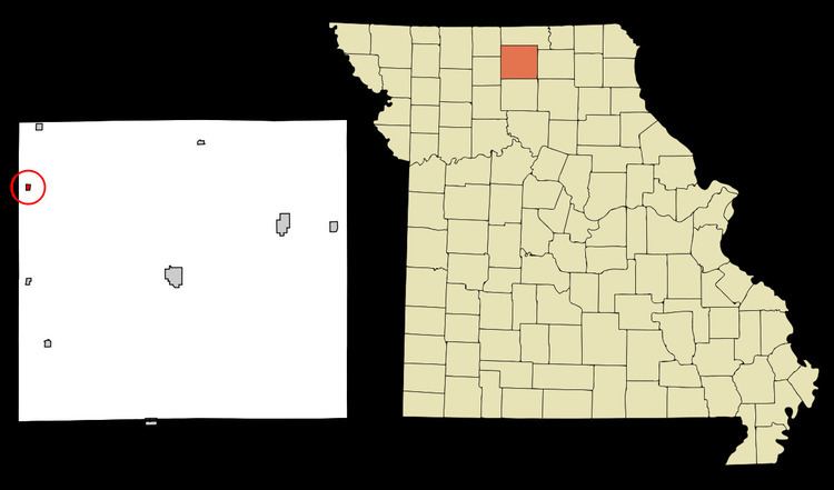
Harris is a city in Sullivan County, Missouri, United States. The population was 61 at the 2010 census, at which time it was a town.
Contents
Map of Harris, MO 64645, USA
History
Harris was laid out in 1887. The community was named for A. W. Harris, an early settler. A post office was established at Harris in 1887.
Geography
Harris is located at 40°18′19″N 93°21′01″W.
According to the United States Census Bureau, the city has a total area of 0.15 square miles (0.39 km2), all of it land.
2010 census
As of the census of 2010, there were 61 people, 30 households, and 14 families residing in the city. The population density was 406.7 inhabitants per square mile (157.0/km2). There were 50 housing units at an average density of 333.3 per square mile (128.7/km2). The racial makeup of the city was 98.4% White and 1.6% from two or more races.
There were 30 households of which 36.7% had children under the age of 18 living with them, 23.3% were married couples living together, 16.7% had a female householder with no husband present, 6.7% had a male householder with no wife present, and 53.3% were non-families. 50.0% of all households were made up of individuals and 10% had someone living alone who was 65 years of age or older. The average household size was 2.03 and the average family size was 2.64.
The median age in the city was 32.5 years. 32.8% of residents were under the age of 18; 13.1% were between the ages of 18 and 24; 21.4% were from 25 to 44; 22.9% were from 45 to 64; and 9.8% were 65 years of age or older. The gender makeup of the city was 50.8% male and 49.2% female.
2000 census
As of the census of 2000, there were 105 people, 44 households, and 28 families residing in the town. The population density was 676.1 people per square mile (253.4/km²). There were 49 housing units at an average density of 315.5/sq mi (118.2/km²). The racial makeup of the town was 96.19% White, 0.95% Native American, 0.95% from other races, and 1.90% from two or more races. Hispanic or Latino of any race were 6.67% of the population.
There were 44 households out of which 36.4% had children under the age of 18 living with them, 40.9% were married couples living together, 20.5% had a female householder with no husband present, and 34.1% were non-families. 34.1% of all households were made up of individuals and 18.2% had someone living alone who was 65 years of age or older. The average household size was 2.39 and the average family size was 3.00.
In the town the population was spread out with 33.3% under the age of 18, 7.6% from 18 to 24, 26.7% from 25 to 44, 10.5% from 45 to 64, and 21.9% who were 65 years of age or older. The median age was 33 years. For every 100 females there were 101.9 males. For every 100 females age 18 and over, there were 94.4 males.
The median income for a household in the town was $20,500, and the median income for a family was $28,438. Males had a median income of $25,625 versus $13,750 for females. The per capita income for the town was $7,952. There were 20.0% of families and 15.9% of the population living below the poverty line, including 10.4% of under eighteens and 26.7% of those over 64.