
Country United States FIPS code 01-33256 Elevation 139 m Zip code 35078 Local time Thursday 10:54 PM | Time zone CST (UTC-6) GNIS feature ID 0119777 Area 41.1 km² Population 1,676 (2013) Area code 205 | |
 | ||
Weather 4°C, Wind N at 2 km/h, 71% Humidity | ||
Help harpersville alabama traffic speeding ticket lawyer best harpersville al traffic attorney
Harpersville is a town in Shelby County, Alabama, United States. According to the 1950 U.S. Census, it formally incorporated in 1943. At the 2010 census, the population was 1,637, up from 1,620 in 2000. It is located southeast of Birmingham metro area.
Contents
- Help harpersville alabama traffic speeding ticket lawyer best harpersville al traffic attorney
- Map of Harpersville AL USA
- History
- Geography
- 2000 Census
- 2010 Census
- Economy
- Government
- Notable people
- References
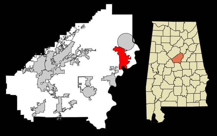
Map of Harpersville, AL, USA
History
Harpersville was settled just after the War of 1812 ended. It was originally called Big Springs.
Harpersville Municipal Court has been effectively taken over by Circuit Court Judge Hub Harrington as of 13 July 2012 in a case regarding Private probation. His order characterizes the municipal court as a debtors' prison and extortion racket condoned by the elected officials of Harpersville and Judicial Correction Services.
Harpersville has two structures which are listed on the National Register of Historic Places, the Chancellor House and the Old Rock House.
Geography
Harpersville is located at 33°19′33″N 86°25′34″W (33.325848, -86.426121). According to the U.S. Census Bureau, the town has a total area of 15.9 square miles (41 km2), of which 15.9 square miles (41 km2) is land and 0.06% is water.
2000 Census
As of the census of 2000, there were 1,620 people, 610 households, and 458 families residing in the town. The population density was 102.0 people per square mile (39.4/km²). There were 685 housing units at an average density of 43.1 per square mile (16.7/km²). The racial makeup of the town was 69.57% White, 28.70% Black or African American, 0.49% Native American, 0.68% Asian, 0.25% from other races, and 0.31% from two or more races. 0.62% of the population were Hispanic or Latino of any race.
There were 610 households out of which 33.9% had children under the age of 18 living with them, 57.4% were married couples living together, 14.8% had a female householder with no husband present, and 24.8% were non-families. 21.8% of all households were made up of individuals and 9.2% had someone living alone who was 65 years of age or older. The average household size was 2.66 and the average family size was 3.10.
In the town, the population was spread out with 27.3% under the age of 18, 7.5% from 18 to 24, 30.0% from 25 to 44, 23.0% from 45 to 64, and 12.3% who were 65 years of age or older. The median age was 37 years. For every 100 females there were 93.5 males. For every 100 females age 18 and over, there were 87.6 males.
The median income for a household in the town was $31,655, and the median income for a family was $34,632. Males had a median income of $28,839 versus $22,069 for females. The per capita income for the town was $12,783. About 17.4% of families and 19.3% of the population were below the poverty line, including 23.6% of those under age 18 and 24.1% of those age 65 or over.
2010 Census
As of the census of 2010, there were 1,637 people, 620 households, and 456 families residing in the town. The population density was 103.0 people per square mile (39.8/km²). There were 708 housing units at an average density of 44.5 per square mile (17.2/km²). The racial makeup of the town was 73.1% White, 23.5% Black or African American, 0.3% Native American, 0.7% Asian, 1.0% from other races, and 1.3% from two or more races. 2.6% of the population were Hispanic or Latino of any race.
There were 620 households out of which 26.5% had children under the age of 18 living with them, 51.5% were married couples living together, 16.9% had a female householder with no husband present, and 26.5% were non-families. 21.1% of all households were made up of individuals and 9.3% had someone living alone who was 65 years of age or older. The average household size was 2.64 and the average family size was 3.09.
In the town, the population was spread out with 23.1% under the age of 18, 8.9% from 18 to 24, 22.9% from 25 to 44, 30.2% from 45 to 64, and 14.8% who were 65 years of age or older. The median age was 41.7 years. For every 100 females there were 91.5 males. For every 100 females age 18 and over, there were 95.0 males.
The median income for a household in the town was $37,768, and the median income for a family was $42,065. Males had a median income of $43,301 versus $32,434 for females. The per capita income for the town was $20,170. About 23.9% of families and 28.4% of the population were below the poverty line, including 55.3% of those under age 18 and 23.4% of those age 65 or over.
Economy
Harpersville is growing due to the growth of big business on Highway 280. The town contains Morgan Creek Vineyards, Baker's Christmas Tree Farm, a historic graveyard, Shelby Sod farm, a drive in movie theater, numerous cotton fields, a public park, two private schools, and numerous subdivisions.
Government
The current mayor, Theoangelo Perkins, is the first African American mayor in Shelby County.