
Time zone PST (UTC+5) Area 772 km² | Province Punjab Number of Union councils 22 Elevation 178 m | |
 | ||
Neighborhoods Al Waqar Colony, Chak 73/4-R, Pakistan Town | ||
Nikah mubarak at chak no 20 3r haroonabad bahawalnagar punjab pakistan
Haroonabad or Harunabad (Punjabi, Urdu: ہارون آباد) is a Tehsil (sub-district) in Bahawalnagar District of the Punjab Province of Pakistan. The town is the headquarters of Haroonabad Tehsil and administrative subdivision of the district.
Contents
- Nikah mubarak at chak no 20 3r haroonabad bahawalnagar punjab pakistan
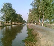
- Map of Haroonabad Pakistan
- History
- Administration
- Economy
- Climate
- People from Haroonabad
- References
Map of Haroonabad, Pakistan
History
Haroonabad Town is a Tehsil Headquarter and an important Mandi Town of Bahawalnagar District. The history of the Town is not very old. It was laid out and established as a Mandi Town under the Satluj valley project during the colonization of the region in English rule in second decade of the 20th century. Before the colonization the site of the present Haroonabad Town was known as Toba Badru Wala. The word "Toba" in the local language means pond. It is said that there was a big natural pond to the north side of railway station at a small distance where rain water was collected. Availability of water in this deserted area had attracted the natives. The main occupation of natives was cattle farming and cultivation on small scale during the rainy season. The cast of local people who lived there was "Joiya Badru". This small settlement was named as "Toba Badru Wala" because of their caste.
In the year 1927, the branch railway line linking Forrtabbas Town with Bahawalnagar city was constructed. The Railway Station at Haroonabad Town was built in the same year and was called "Badru Wala Station". Grain Market, a few shops and dwelling units were developed along Chaman Bazar, Railway Bazar and Main Bazar in the beginning. Establishment of irrigation system/canal system under the Satluj valley project in 1934, added to the agricultural production of the hinterland and provided a significant economic base to this small settlement. The construction of 3R and 4R Canals in the region brought the most of the area under irrigation system and the town began to flourish as a Mandi Town rapidly due to increasing economic and commercial activities. The town was renamed as Haroonabad Town after the name of Prince Haroon-ur-Rashid, the son of Nawab of Bahawalpur Sir Sadiq Muhammad Khan Khamis.
At the time of partition of subcontinent in 1947, a large number of refugees settled here and the population of the Town was substantially increased. Development of some residential colonies, establishment of social services like educational and health institutions and provision of public utilities made living condition in town more attractive and resulted in rapid growth.
Administration
Haroonabad consists of 26 Unions which are mostly villages. The only noticeable sub-urban town is Faqirwali apart from Haroonabad city's own unions.
Economy
The economy is based around agriculture, cotton being of major importance, followed by cauliflower. The headquarters of two national brands of tea are also here, Vital Tea and Prime Tea. Wastewater is not used for irrigation.
Climate
The climate of Haroonabad is hot and humid. The temperature extremes occur during the months of May, June, and July, when the temperature reaches up to 49–53 °C. In August, the monsoon seasons starts, with heavy rainfall throughout the area. December and January are the coldest months, when temperatures can drop down to –1 °C.
The annual average rainfall is 160 mm.
People from Haroonabad
kashif 69/4r
Haji Naeem SiddiqBig text