
Gaelic name Eilean Heàrrlois OS grid reference NG278393 Sovereign state United Kingdom Area 28 ha Lieutenancy area Highland | Meaning of name "river mouth island"? Highest elevation 51 m Country Scotland Council area Highland | |
 | ||
Island groups British Isles, Inner Hebrides | ||
Harlosh Island is an island in Loch Bracadale just off the coast of the Minginish and Harlosh peninsulas of Skye in Scotland.
Map of Harlosh Island, United Kingdom
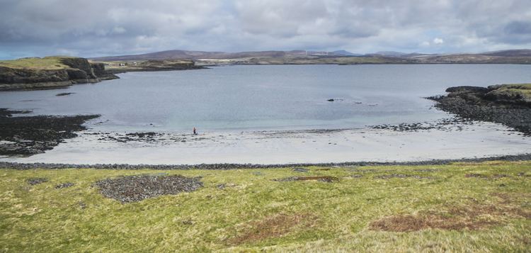
The island is about 28 hectares (69 acres) in extent and the coastline, which is largely cliff-lined, has a cave on the west coast. At low tide it is only about 100 metres (330 ft) from mainland Skye. Harlosh Skerry lies just offshore to the north west. At low tide on the northern coast there is a large sand bay, however, watercraft should take caution when attempting to land in the bay as several rock formations pose a navigational hazard at low tide.
The name "Harlosh" is of Old Norse origin and may refer to a river mouth, although the meaning is not clear.
References
Harlosh Island Wikipedia(Text) CC BY-SA