
Country United States Elevation 541 ft (165 m) Area code(s) 256 Zip code 35077 Local time Wednesday 1:28 PM | Time zone Central (CST) (UTC-6) FIPS code 01-32968 Population 3,205 (2013) | |
 | ||
Weather 4°C, Wind NW at 13 km/h, 36% Humidity University | ||
Hanceville is a city in Cullman County, Alabama, United States. At the 2010 census the population was 3,096.
Contents
- Map of Hanceville AL 35077 USA
- History
- Geography
- Demographics
- 2010 census
- Attractions
- Education
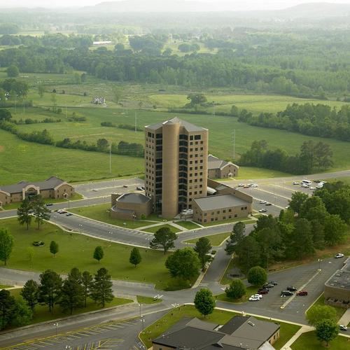
- Colleges and universities
- Notable people
- References
Map of Hanceville, AL 35077, USA
History
Founded in Blount County, Hanceville was incorporated in May 1879. At the time of Cullman County's creation in 1877, half of Hanceville resided in each county. In 1885, county boundaries were redrawn and all of Hanceville was placed within Blount County. In 1901, county boundaries were redrawn again and this time all of the town was placed within Cullman County, for which it has remained.
Geography
Hanceville is located in southeastern Cullman County at 34°3′48″N 86°45′39″W (34.063463, -86.760908). U.S. Route 31 passes through the city, leading north 9 miles (14 km) to Cullman, the county seat, and south 14 miles (23 km) to Smoke Rise.
According to the U.S. Census Bureau, the city has a total area of 4.2 square miles (10.9 km2), of which 0.02 square miles (0.04 km2), or 0.34%, is water.
Demographics
As of the census of 2000, there were 2,951 people, 1,167 households, and 710 families residing in the city. The population density was 718.6 people per square mile (277.2/km²). There were 1,323 housing units at an average density of 322.2 per square mile (124.3/km²). The racial makeup of the city was 93.09% White, 4.61% Black or African American, 0.61% Native American, 0.07% Asian, 0.03% Pacific Islander, 0.75% from other races, and 0.85% from two or more races. 2.30% of the population were Hispanic or Latino of any race.
There were 1,167 households out of which 24.0% had children under the age of 18 living with them, 45.8% were married couples living together, 11.5% had a female householder with no husband present, and 39.1% were non-families. 32.6% of all households were made up of individuals and 12.1% had someone living alone who was 65 years of age or older. The average household size was 2.23 and the average family size was 2.84.
In the city, the population was spread out with 17.8% under the age of 18, 17.7% from 18 to 24, 22.0% from 25 to 44, 21.2% from 45 to 64, and 21.3% who were 65 years of age or older. The median age was 38 years. For every 100 females there were 87.5 males. For every 100 females age 18 and over, there were 80.8 males.
The median income for a household in the city was $26,351, and the median income for a family was $35,370. Males had a median income of $31,439 versus $18,112 for females. The per capita income for the city was $13,371. About 12.5% of families and 21.9% of the population were below the poverty line, including 28.9% of those under age 18 and 13.5% of those age 65 or over.
2010 census
As of the census of 2010, there were 2,982 people, 1,233 households, and 691 families residing in the city. The population density was 733 people per square mile (283.1/km²). There were 1,439 housing units at an average density of 340.2 per square mile (131.4/km²). The racial makeup of the city was 92.4% White, 3.6% Black or African American, 0.2% Native American, 0.7% Asian, 0.0% Pacific Islander, 1.4% from other races, and 1.6% from two or more races. 2.4% of the population were Hispanic or Latino of any race.
There were 1,233 households out of which 23.3% had children under the age of 18 living with them, 38.1% were married couples living together, 13.6% had a female householder with no husband present, and 44.0% were non-families. 37.1% of all households were made up of individuals and 17.0% had someone living alone who was 65 years of age or older. The average household size was 2.26 and the average family size was 2.98.
In the city, the population was spread out with 21.6% under the age of 18, 10.9% from 18 to 24, 22.5% from 25 to 44, 22.1% from 45 to 64, and 22.8% who were 65 years of age or older. The median age was 40.0 years. For every 100 females there were 83.1 males. For every 100 females age 18 and over, there were 95.2 males.
The median income for a household in the city was $30,903, and the median income for a family was $45,560. Males had a median income of $34,338 versus $35,417 for females. The per capita income for the city was $16,078. About 14.5% of families and 24.2% of the population were below the poverty line, including 28.1% of those under age 18 and 9.8% of those age 65 or over.
Attractions
Hanceville is home to Our Lady of the Angels Monastery. The construction began in 1996 and was completed in 1999, under the direction of Mother Angelica of the Eternal Word Television Network (EWTN).
Education
Hanceville High School serves 342 students in grades 9-12. The school colors are purple and gold, and its mascot are the Bulldogs. It is a member of the Cullman County Board of Education.[1] In 2001 the Lady Bulldogs basketball team won the Alabama High School Athletic Association Class 3A State Championship.[2]