
Founded October 25, 1819 Area 1,492 km² Unemployment rate 5.0% (Apr 2015) | Website www.hamiltontn.gov Population 348,673 (2013) | |
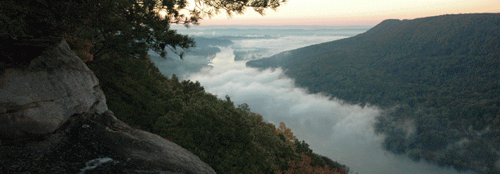 | ||
Colleges and Universities University of Tennesse, Chattanooga State Communi, Southern Adventist University, Tennessee Temple University, Miller‑Motte Technical College‑Chattanooga Points of interest Tennessee Valley Railroad, Rock City, Ruby Falls, Hunter Museum of American, Lookout Mountain | ||
Hamilton County is a county located in the U.S. state of Tennessee. As of the 2010 census, the population was 336,463, making it the fourth-most populous county in Tennessee. Its county seat is Chattanooga. The county was named for Alexander Hamilton, the first Secretary of the Treasury.
Contents
- Map of Hamilton County TN USA
- History
- Geography
- Natural areas of interest
- National protected area
- State protected areas
- Major highways
- Demographics
- Politics
- Colleges and universities
- Public schools
- Towns
- References
Map of Hamilton County, TN, USA
Hamilton County is part of the Chattanooga, TN-GA Metropolitan Statistical Area.
History
Hamilton County was formed on October 25, 1819 from portions of Rhea County and Indian land. It was named after Alexander Hamilton, an officer in the American Revolutionary War, member of the Continental Congress, the first US Secretary of Treasury, and one of the founding fathers of the United States.
Hamilton County was the site of an important saltpeter mine during the Civil War. Saltpeter is the main ingredient of gunpowder and was obtained by leaching the earth from caves. Lookout Mountain Cave was a major source of saltpeter during the Civil War. The mine was operated by Robert Cravens, who owned the property where the cave is located. In May 1861, Cravens contracted with the Tennessee Military and Financial Board to deliver 20,000 pounds of saltpeter. On the 24th of the same month, he reported that he had ten hoppers already set up in his cave. Cravens was also mining Nickajack Cave in nearby Marion County. In 1862 he quit mining at Lookout Mountain Cave and rented the cave to the Confederate Nitre and Mining Bureau, which mined the cave from June 1862 through July 1863. Mining ceased when Chattanooga was occupied by Federal forces in 1863.
In 1919 James County, Tennessee went bankrupt and became a part of Hamilton County in April 1919. James County had been established by the Tennessee General Assembly in January 1871 and was named after Reverend Jesse J. James.
Geography
According to the U.S. Census Bureau, the county has a total area of 576 square miles (1,490 km2), of which 542 square miles (1,400 km2) is land and 33 square miles (85 km2) (5.8%) is water. Hamilton County is one of the few counties in the United States to border 10 other counties.
Natural areas of interest
Raccoon Mountain Caverns is a show cave located 8 miles northwest of downtown Chattanooga. It was originally explored in 1929 by Leo Lambert who developed trails and installed lights and opened the cave to the public on June 28, 1931. The cave was opened under the name Tennessee Caverns. The operators of the cave claim that its explored length is over 5.5 miles.
The Crystal Caverns Cave Spider, Nesticus furtivus, is only known from this one cave. Cave guides will occasionally spot one of these rare spiders and point it out to the tourists.
Ruby Falls Cave is a show cave located on the side of Lookout Mountain south of downtown Chattanooga. It was discovered by accident on December 28, 1928 when it was intersected by an elevator shaft that was being drilled to develop Lookout Mountain Cave as a commercial cave. Ruby Falls Cave was intersected at a depth of 260 from the surface and Lookout Mountain Cave was reached later at a depth of 420 feet below the surface. The entire project was the work of cave developer Leo Lambert. He named the new cave's waterfall after his wife Ruby. The lower cave, Lookout Mountain Cave, opened to the public on December 30, 1929. Ruby Falls opened to the public on June 16, 1930. Ruby Falls Cave, with its spectacular waterfall proved the more popular of the two caves and it is the only one open to the public at the present time.
National protected area
State protected areas
Major highways
Demographics
As of the census of 2000, there were 307,896 people, 124,444 households, and 83,750 families residing in the county. The population density was 568 people per square mile (219/km²). There were 134,692 housing units at an average density of 248 per square mile (96/km²). The racial makeup of the county was 76.32% White, 20.14% Black or African American, 0.29% Native American, 1.27% Asian, 0.06% Pacific Islander, 0.77% from other races, and 1.14% from two or more races. 1.78% of the population were Hispanic or Latino of any race.
There were 124,444 households out of which 28.90% had children under the age of 18 living with them, 50.20% were married couples living together, 13.50% had a female householder with no husband present, and 32.70% were non-families. 27.90% of all households were made up of individuals and 10.00% had someone living alone who was 65 years of age or older. The average household size was 2.41 and the average family size was 2.95.
In the county, the population was spread out with 23.20% under the age of 18, 9.60% from 18 to 24, 29.00% from 25 to 44, 24.30% from 45 to 64, and 13.80% who were 65 years of age or older. The median age was 37 years. For every 100 females there were 91.70 males. For every 100 females age 18 and over, there were 88.10 males.
The median income for a household in the county was $38,930, and the median income for a family was $48,037. Males had a median income of $35,413 versus $24,505 for females. The per capita income for the county was $21,593. About 9.20% of families and 12.10% of the population were below the poverty line, including 16.80% of those under age 18 and 11.20% of those age 65 or over.
Politics
Politically, Hamilton County is conservative. Along with the rest of East Tennessee, it has been supportive of the Republican party since the Civil War, even as the rest of the Solid South voted staunchly Democratic. In 2004, Republican George Bush defeated Democrat John Kerry 57% to 41%. The last Democrat to win the county was Harry S. Truman in 1948, although George Wallace did win a plurality in 1968.
In 2008, Republican John McCain defeated Democrat Barack Obama by a slightly smaller margin of 55% to 43%. In 2012, Republican Mitt Romney defeated incumbent Obama by a margin of 56% to 41%. Then again in 2016, in businessman Donald Trump's sweep of Appalachia, Hamilton County furnished the GOP with a mildly increased margin of 55.75% to 39.17% for Secretary of State Hillary Clinton.
Colleges and universities
Public schools
Public schools in Hamilton County are operated by Hamilton County Schools.