
Elevation 314 m Population 803 (1 Jan 2012) | Postal code 683 02 Area 5.49 km² | |
 | ||
Website | ||
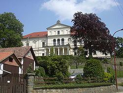
Habrovany is a village and municipality (obec) in Vyškov District in the South Moravian Region of the Czech Republic.
Map of 683 01 Habrovany, Czechia
The municipality covers an area of 5.49 square kilometres (2.12 sq mi), and has a population of 767 (as at 3 July 2006).
Habrovany lies approximately 10 kilometres (6 mi) south-west of Vyškov, 20 km (12 mi) east of Brno, and 202 km (126 mi) south-east of Prague.
References
Habrovany (Vyškov District) Wikipedia(Text) CC BY-SA