
Country Algeria Time zone CET (UTC+01) ONS code 1641 Population 18,167 (1998) | Postal code 16900 Area 13 km² | |
 | ||
Alg rie baraki les eucalyptus h raoua 4500 logements distribuer
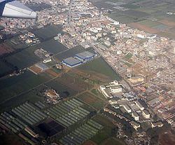
H'raoua is a municipality in Algiers province, Algeria. It is located in Rouïba district, and is an outer suburb of Algiers. It has a small coastline on the Mediterranean Sea. The town proper (chef-lieu agglomeration) of H'raoua is located 2 kilometers (1.2 mi) from the beaches of Terfaya and Kadous. It was created out of parts of Aïn Taya in 1984. Currently, it is the site of the construction of 1853 homes.
Contents
Map of H'raoua, Algeria
References
H'raoua Wikipedia(Text) CC BY-SA