
Location Far North Width 360 km (224 mi) Area 160,000 km² | Length 400 km (250 mi) Highest elevation 1,125 m (3,691 ft) | |
 | ||
Federal subject Yamal-Nenets autonomous district Adjacent bodies of water Gulf of Ob, Kara Sea, Yenisei Gulf | ||
Gydan peninsula
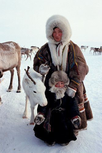
The Gydan Peninsula (Russian: Гыда́нский полуостров) is a geographical feature of the Siberian coast in the Kara Sea. It is roughly 400 km long and 360 km wide. This wide peninsula lies between the estuaries of the Ob (Gulf of Ob) and Yenisei Rivers (Yenisei Gulf). The southwestern corner of the peninsula is limited by the Taz Estuary. The climate in the whole area of the peninsula is arctic and harsh.
Contents
Geography
The Gydan Peninsula is mostly flat, with numerous lakes and rivers. Its ground consists of permafrost and is covered by tundra.
This peninsula has a few arms or subpeninsulas extending northwards into the Kara Sea, where there are some large islands off its shores, including Oleniy, Shokalsky and Vilkitsky Islands. There are two bays in its northern coast, narrow and deep Khalmyer Bay and smaller Yuratski Bay. The peninsula formed between the Khalmyer Bay and neighbouring Yuratski Bay is known as the Mamonta Peninsula (Russian: Полуостров Мамонта; Poluostrov Mamonta, meaning 'Mammoth Peninsula') and the narrow peninsula in the NW formed between this bay and the neighbouring Gulf of Ob is known as the Yavay Peninsula (Russian: полуостров Явай; Poluostrov Yavay).
The Gydan Peninsula is located in the Yamal-Nenets autonomous district administrative region of the Russian Federation. It appears also in the genitive as Gydansky or Gydanskiy Peninsula in many common maps in English.
A notable archeological find from the peninsula is a mammoth skeleton, now housed in a zoological museum in Saint Petersburg.