
Country Mexico Established 1931 Elevation 2,243 m (7,359 ft) Local time Saturday 11:01 PM | Federal entity D.F. Area 88.09 km² | |
 | ||
Seat Calle 5 de Febrero esq. Vicente Villada, Col. Villa Gustavo A. Madero, C.P. 07050 Weather 17°C, Wind N at 14 km/h, 57% Humidity Colleges and Universities Instituto Politécnico Nacional, Instituto Tecnológico de Gusta, CINVESTAV, ESCOM, ESIQIE | ||
Gustavo A. Madero is one of the 16 municipalities into which Mexico City is divided.
Contents
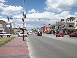
Map of Gustavo A. Madero, CDMX, Mexico
Origins
Founded as "Villa de Guadalupe" in 1563, it became the city of "Villa de Guadalupe Hidalgo" in 1828, and finally a delegación in 1931. It was named after Gustavo A. Madero, the brother and fellow revolutionary of President Francisco I. Madero.
Characteristics
The area houses the Basílica de Guadalupe, the shrine of Our Lady of Guadalupe at the foot of Tepeyac Hill, where Roman Catholics believe the Virgin Mary appeared to the indigenous Mexican Juan Diego Cuauhtlatoatzin in 1531.
Being the northern-most borough, the Northern Central Bus Station (Terminal Central del Norte) is located here, providing constant bus runs to all major cities in the northern and western part of the country.
History
The Treaty of Guadalupe Hidalgo, ending the Mexican-American War of 1846–48 was signed in Gustavo A. Madero.
Education
Public high schools of the Instituto de Educación Media Superior del Distrito Federal (IEMS) include:
Private schools: