
ZIP codes 80301, 80503 Elevation 1,610 m Population 9,263 (2010) | Time zone MST (UTC-7) Area code(s) 303, 720 Area 16.6 km² | |
 | ||
Gunbarrel is a census-designated place (CDP) in Boulder County, Colorado, United States. The population was 9,263 at the 2010 census. Gunbarrel is a developed (built-up) area of Boulder County, but it is not an incorporated town or village. Gunbarrel locations may have postal addresses indicating Boulder, Niwot, or Longmont as the city.
Contents
Map of Gunbarrel, CO, USA
The term Gunbarrel is also used colloquially to refer to a larger area, which includes parts of the city of Boulder and rural portions of Boulder County in addition to the CDP. However, this article is about the CDP specifically.
Geography
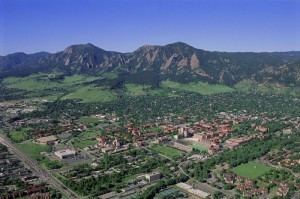
Gunbarrel is located at 40°3′56″N 105°11′15″W (40.065482, -105.187523). It is northeast of the city of Boulder proper, separated by a buffer area of private agricultural lands and publicly owned open space. The buffer areas provide over two miles (3 km) of separation over changing elevations. This reduces the impact of the Boulder Municipal Airport and the Boulder County Sheriff's Department facilities (including the county jail), which are located on the southern side of the buffer.
Two reservoirs operated by the Boulder and Left Hand Irrigation Company are located in central Gunbarrel. Irrigation ditches and canals, including the Boulder and Whiterock Ditch, pass though this primarily residential area. The Twin Lakes Open Space, a large park which includes the two reservoirs and extends west along the ditch, is operated by the Boulder County Parks and Open Space Department. The park brings protected wetlands, jogging trails and green spaces directly into the urban area. The City of Boulder operates Eaton Park, adjacent to the west lake. Eaton Park includes picnic facilities, BMX jumps and additional protected wetland. Flood control facilities are integral to the reservoir and canal systems, but they do not eliminate the flood risk to adjacent development.
According to the United States Census Bureau, the CDP has a total area of 6.4 square miles (17 km2), of which, 6.4 square miles (17 km2) of it is land and 0.04 square miles (0.10 km2) of it (0.47%) is water.
Natural hazards
The principal natural hazard in Gunbarrel is flooding. The county Transportation Department provides floodplain information through an online request page, free of charge for property owners in the unincorporated areas of the county, including Gunbarrel. Boulder County participates in the National Flood Insurance Program which allows some reduction in the cost of flood insurance for residents.
Demographics
As of the census of 2010, there were 9,435 people, 4,024 households, and 2,547 families residing in the CDP. The population density was 1,471.9 people per square mile (568.3/km²). There were 4,237 housing units at an average density of 661.0 per square mile (255.2/km²). The racial makeup of the CDP was 79.78% White, 9.35% African American, 0.41% Native American, 2.73% Asian, 0.14% Pacific Islander, 0.93% from other races, and 1.65% from two or more races. Hispanic or Latino of any race were 10.84% of the population.
There were 4,024 households out of which 28.4% had children under the age of 18 living with them, 54.4% were married couples living together, 6.3% had a female householder with no husband present, and 36.7% were non-families. 25.4% of all households were made up of individuals and 4.1% had someone living alone who was 65 years of age or older. The average household size was 2.34 and the average family size was 2.86.
In the CDP, the population was spread out with 22.0% under the age of 18, 7.0% from 18 to 24, 31.5% from 25 to 44, 30.7% from 45 to 64, and 8.8% who were 65 years of age or older. The median age was 40 years. For every 100 females there were 101.1 males. For every 100 females age 18 and over, there were 99.6 males.
The median income for a household in the CDP was $67,022, and the median income for a family was $86,922. Males had a median income of $60,994 versus $37,091 for females. The per capita income for the CDP was $36,478. About 5.0% of families and 6.8% of the population were below the poverty line, including 9.5% of those under age 18 and 3.8% of those age 65 or over.
Government
The Gunbarrel Public Improvement District (GPID), formerly the Gunbarrel General Improvement District, was formed by residents of Gunbarrel in 1993. At the time, county residents were concerned about the negative effects of development in the adjacent neighborhoods of the city of Boulder. They felt they needed to counterbalance the city's annexation and development powers and better manage the traffic city development was creating. The GPID is administered by the Boulder County commissioners. The GPID is a 'special district' under Colorado law, with the ability to levy taxes and incur debt. GPID uses this money to purchase open space and improve roads in the unincorporated subdivisions, consistent with their primary mission of maintaining quality of life and property values in unincorporated Gunbarrel. GPID open space lands are managed by Boulder County Parks and Open Space. A map of GPID lands can be found at the Gunbarrel Community Association website. This map also depicts the boundaries of the District's taxation area.
Transportation
The 205 bus of the RTD bus system gives service throughout Gunbarrel and into Boulder. Roads and streets in Gunbarrel are maintained by Boulder County. The RTD regional route J also provides a peak hours connection to the University of Colorado and Longmont.