Isolation 7 km (4.3 mi) Elevation 2,458 m | Prominence 574 m | |
 | ||
Similar Le Rubli, Rocher du Midi, La Videmanette, Vanil Noir, Le Tarent | ||
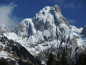
The Gummfluh is a mountain in the western Bernese Alps, located on the border between the Swiss cantons of Vaud and Berne. It is the highest peak in the chain of mountains on the south side of the Pays d'Enhaut and it lies approximately halfway between Château d'Oex and Gstaad. The northern slopes form part of the large nature reserve of La Pierreuse.
Map of Gummfluh, 1660 Rougemont, Switzerland
References
Gummfluh Wikipedia(Text) CC BY-SA
