
Established 1839 Founded 1839 Local time Sunday 8:05 AM | Postcode(s) 5233 State electorate(s) Schubert Postal code 5233 | |
 | ||
Population 1,018 (2011 census)731 (2006 census) Location 37 km (23 mi) from Adelaide Weather 15°C, Wind W at 23 km/h, 82% Humidity | ||
Gumeracha (/ˌɡʌməˈrækə/ GUM-ə-RAK-ə) is a town in the Adelaide Hills, South Australia, located on the Adelaide-Mannum Road. It is located in the Adelaide Hills Council local government area. At the 2006 census, Gumeracha had a population of 731.
Contents
Map of Gumeracha SA 5233, Australia
History
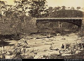
Gumeracha is one of South Australia's oldest settled areas. The first Europeans to explore and traverse through the district were Dr George Imlay and John Hill on 24 January 1838. In 1839, the South Australia Company took up a parcel of land, on which the settlements of Gumeracha, Kenton Valley and Forreston developed. The Company established a district headquarters and opened it up for sheep grazing.
In 1839, William Beavis Randell built his home, Tinmath, at Kenton Park and built a flour mill in the 1840s. The estate housed his large family, his workforce and their families. In 1846, Randell donated land and funds for a church, and the Salem Baptist Church was built - the oldest Baptist church still in use in South Australia. The surrounding area, meanwhile, had become an agricultural centre, and the Gumeracha Farmers' Society held annual shows.
In 1855, Randell allocated land for a township and by 1860 the town was laid out. Commercial businesses sprang up on the main street (Albert Street), and many fine buildings were erected, including the Post Office, Police Station & Court House (1864), Institute Hall, Town Hall (1909), a butter factory (1889), a school, a hospital, a coach-house, hotels, churches and business houses. Most of the buildings in use at this time still stand today. William Beavis Randell's son, William Richard Randell, would build the first River Murray paddlesteamer in Gumeracha in 1852.
The region relies heavily on grazing, dairying, grape growing, orchards and market gardening.
Geography
Gumeracha is located between Inglewood and Birdwood along the Adelaide-Mannum Road, and north of Lobethal along the Gumeracha-Lobethal Road.
At the ABS 2001 census, Gumeracha had a population of 599 people living in 266 dwellings.
Facilities
Gumeracha is the regional centre for the area. It contains a primary school, hospital, community centre, sports facilities and council offices of the Adelaide Hills Council (the main office is at Woodside). There is also a golf course in Kenton Valley south of the town.
Several wineries, including Chain of Ponds Wines and Talunga Premium Wines, operate in Gumeracha and in nearby areas.
The most notable attraction of Gumeracha is the "biggest rocking horse in the world" - standing at 18.3 metres (60.0 ft) (approximately the height of a six-storey building), it is just east of the town on Main Road and serves to advertise the toy factory and wildlife park.
Transport
The area is not serviced by Adelaide public transport. A coach is operated from Tea Tree Plaza Interchange to Gumeracha and Mount Pleasant by LinkSA.