
Country Philippines Barangays Area 90.53 km² Province Zamboanga del Sur | Founded October 17, 1991 Time zone PST (UTC+8) Local time Sunday 1:00 AM | |
 | ||
Region Zamboanga Peninsula (Region IX) District 2nd district of Zamboanga del Sur Weather 24°C, Wind SW at 0 km/h, 95% Humidity | ||
Guipos is a fourth class municipality in the province of Zamboanga del Sur, Philippines. According to the 2015 census, it has a population of 20,729 people.
Contents
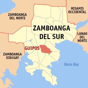
Map of Guipos, Zamboanga del Sur, Philippines
The town was officially established on October 7, 1991, by virtue of Republic Act No. 7159, signed by President Corazon C. Aquino. It was formed from barangays Guipos, Katipunan, Bagong Oroquieta, and Dalapang of the Municipality of San Miguel; barangays Datagan, Dagohoy, Balongating, Baguitan, Magting, Sikatuna, Dacsol, Guling, and Canunan of the Municipality of Dumalinao; barangays Lintum, Singclot and Litan of the Municipality of Dinas; and barangay Regla of the Municipality of San Pablo.
Barangays
Guipos is politically subdivided into 17 barangays.
References
Guipos, Zamboanga del Sur Wikipedia(Text) CC BY-SA