
Country Philippines Barangays ZIP code 4503 Province Albay | District 3rd district Time zone PST (UTC+8) Area 244.4 km² | |
 | ||
Region Bicol Region (Region V) Neighborhoods San Rafael, San Francisco, Calzada, Iraya | ||
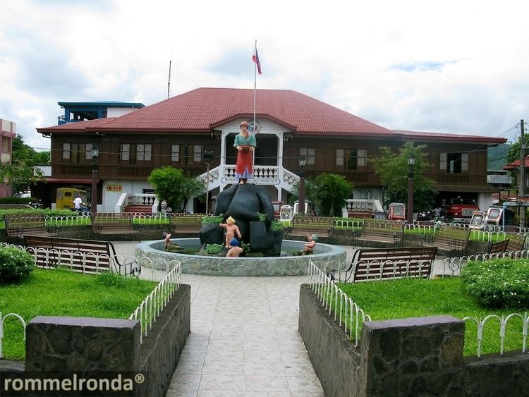
Municipality of guinobatan albay
Guinobatan, officially the Municipality of Guinobatan (Central Bikol: Banwaan kan Guinobatan; Filipino: Bayan ng Guinobatan), is a municipality in the province of Albay in the Bicol Region (Region V) of the Philippines. The population was 82,361 at the 2015 census. In the 2016 electoral roll, it had 48,595 registered voters.
Contents
- Municipality of guinobatan albay
- Map of Guinobatan Albay Philippines
- Bp graduating high school student sa guinobatan albay patay sa pambubugbog
- Legend
- History under foreign rule
- American colonization
- Geography
- Barangays
- Demographics
- Culture
- References
Map of Guinobatan, Albay, Philippines
The town is the birthplace of General Simeón Ola, the last Filipino general to surrender to the Americans after the Philippine-American War.
Bp graduating high school student sa guinobatan albay patay sa pambubugbog
Legend
In the research work "Guinobatan Through the Times," the following version of the legend is stated:
Some versions also state that the town's name is derived from Ginabutan, meaning "a place where trees or plants were uprooted."
History under foreign rule
Luis Nee, a botanist, reached Bikol in January 1792, accompanying the expedition of Capt. Alejandro Malaspina. Nee explored towns near Mayon and including the area now known as Guinobatan. He noted that "trees grew in exuberance making the foothills impenetrable in many parts."
Dr. Leonilo Palacio of Guinobatan’s Republic Colleges mentioned in an essay entitled "Guinobatan and its Church" that "in 1672, the Parish of Guinobatan was already mentioned in books as a visita of the Municipality of Camalig."
In 1890, the title of the gobernadorcillo was changed to Capitan Municipal. The Municipal Law of 1894 guaranteed that the term of the local executive would be extended from two years to four years. Also among the salient provisions of the law was the election of 12 vocales, equivalent to today’s councillors. In 1895, the Colegio de San Buenaventura was also built, making Guinobatan the centre for higher education in Albay.
Cabezas and principales elected the gobernadorcillo until 1863. Until 1847, Guinobatan belonged to Camarines. During the said year,the towns of Quipia, Camalig and Donsol (now in Sorsogon) were ceded to Albay, in exchange for the towns of the Partido de Lagonoy. From 1730-1818, the town transferred from one place to another. In 1730, it was on a site now called Binanuahan. From there, it was the relocated to Bubulusan. During the eruption of 1814, citizens opted to evacuate to higher ground, in Mauraro.
American colonization
During the Philippine Revolution and the Philippine-American War (1898-1911), most of the schoolhouses built by the Spaniards were destroyed by constant artillery fire, most of which came from the Americans. As part of the "pacification" campaign of the Americans, engineers and architects were sent to the Philippines to oversee the construction of public works. Engr. Edward K. Bourne and famed urban planner Daniel Burnham, among other American architects and engineers, were instructed to go to Manila. In response, the Philippine Commission passed Act No. 268 which created the Bureau of Architecture and Construction of Public Buildings. Mr. Bourne was appointed as its head. In 1907, the Philippine Assembly was formed. Angel Roco of Mauraro, Guinobatan represented Albay in the Assembly. The same year,Assemblyman Isauro Gabaldon of Nueva Ecija authored an act which appropriated ₱ 1 million between 1907 and 1915 for "construction of schoolhouses of strong materials in barrios with guaranteed daily attendance of not less than sixty pupils…" Passing into law as Act No. 1801, the act became known as the "Gabaldon Act". Among the salient provisions was that no school could receive more than ₱ 4,000 unless the municipality to which the school belonged contributed at least 50% of the total amount granted to the school by the Gabaldon Act. The Gabaldon Act stipulated that only on land owned by the municipality could schools be constructed. Fifty-one "Gabaldons" were completed by 1911, and by 1916, four hundred five more were constructed. Among those completed between 1911 and 1916 was Guinobatan Central School blg. 1 or the Guinobatan East Central School's Gabaldon Building.
Geography
Guinobatan is located at 13°11′N 123°36′E.
According to the Philippine Statistics Authority, the municipality has a land area of 244.43 square kilometres (94.37 sq mi) constituting 7000949000000000000♠9.49% of the 2,575.77-square-kilometre- (994.51 sq mi) total area of Albay.
The territory of Guinobatan is bordered by a number of municipalities: Camalig on the east, Jovellar on the south, Pio Duran on the south-west, Ligao on the north-west. On the north-east, the town shares with Malilipot, Santo Domingo, Daraga, Tabaco and Legazpi, a common point in the crater of Mayon Volcano.
Barangays
Guinobatan is politically subdivided into 44 barangays.
Demographics
In the 2015 census, Guinobatan had a population of 82,361. The population density was 340 inhabitants per square kilometre (880/sq mi).
In the 2016 electoral roll, it had 48,595 registered voters.
Culture
Guinobatan hosts an annual festival in the celebration of Our Lady of Assumption, its patron saint. Until 2013, the town festival was called "Arandurugan Festival." In August, 2013, Guinobatan celebrated Longganisa Festival, named after the local product listed under the Department of Trade and Industry's "One Town, One Product" program.