
Population 19,851 (2011 census) LGA(s) Cumberland Council Postal code 2161 | Postcode(s) 2161 | |
 | ||
State electorate(s) AuburnGranvilleFairfield | ||
Guildford is a suburb of Sydney, in the state of New South Wales, Australia. Guildford is located 25 kilometres west of the Sydney central business district, in the local government area of Cumberland Council. Guildford is part of the Greater Western Sydney region.
Contents
- Map of Guildford NSW 2161 Australia
- History
- Aboriginal culture
- White settlement
- Multicultural Australia
- Location
- Transport and commercial area
- Landmarks
- Parks
- McCredie Park
- Guildford Park
- Campbell Hill Pioneer Reserve
- Woodville Public Golf Course
- Population
- References
Map of Guildford NSW 2161, Australia
History
Guildford was named in 1837, in honour of the Earl of Guildford.
Guildford is the home of the first KFC in Australia.
Aboriginal culture
Prior to colonisation, the Dharug people lived in small groups across the Cumberland Plain, including in the area which is now the Woodville Ward. The Bidjigal clan lived around the area which is now Guildford.
White settlement
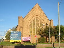
Lieutenant Samuel North was granted 640 acres (2.6 km2) in this area in 1817 and named his property Guildford, as he had ties with the Earl of Guildford. A small hamlet developed in the area around Woodville Road and by 1870 a school had opened here and a church was built here in the 1880s. After the railway station opened in 1876, a new settlement developed around it and the former settlement became known as Old Guildford.
Multicultural Australia
Guildford is one of a small number of Sydney suburbs which houses the most significant portion of the Arabic-speaking diaspora in Australia. The first arrivals were from Lebanon in the 1970s following its civil war and since then numbers have grown to make Guildford one of Australia's true multicultural places, with many other resident nationalities and identities adding to the harmonious mix. The suburb has transformed in only 30 years into what is now a fast-growing and dynamic hub of Arab-Australian society, culture and food in Sydney.
Location
Located in Cumberland Council, Guildford has a variety of schools, parks and sports grounds, pools, a locally significant retail precinct and several neighbourhood shops, a train station with parking, several churches and mosques and is on bus routes to Bass Hill, Yagoona, Bankstown, Harris Park, Merrylands, Parramatta, Liverpool, Auburn and Fairfield. The suburb also has notable commercial and industrial areas.
Transport and commercial area
Guildford railway station is on the Airport, Inner West & South Line of the Sydney Trains network. Guildford CBD is located around Guildford Railway Station.
Major industrial and commercial areas are located around Ferndell St - heading to Chester Hill, Cann St and surrounding streets west side near Guildford Railway Station which run into Yennora (which is 80% industrial).
Landmarks
Guildford is home to historic house Linnwood which is listed as a building of state significance on the New South Wales Heritage Office State Heritage Register.
Linnwood Hall was the Home of George McCredie until his death in 1903. He was a prominent business man (whose brother Arthur was an architect of Sydney's Mark Foy's department store - now Downing Legal Centre), was a Member of Parliament and also Mayor of Municipality of Prospect and Sherwood from 1892-1895.
Sydney's oldest and perhaps most visible above ground water supply pipeline skirts most of the southern boundary of Guildford, and stretches from the pipe head at Guildford West to Potts Hill Reservoir near Bankstown. It passes under several streets, as well as Woodville Rd. (the main arterial road between Liverpool and Parramatta) and over the railway line south of the railway station. The three pipes, each 1.8 metres in diameter were built separately in 1888, 1901 and 1925.
Parks
There are several serviceable parks in Guildford.
McCredie Park
Bounded by Guildford Rd, Tamplin Rd, Fowler Rd and Dennistoun Rd. This park complex consists of the local Swimming Centre and sporting fields. Named after George McCredie and was part of his land grant. He was a prominent local business man, Member of Parliament and Mayor of Municipality of Prospect and Sherwood 1892-1895 (now City of Holroyd).
The Swim Centre consists of an indoor all year round heated pool, outdoor pools, a skateboard track and ample parking. The Sporting fields are run by the Guildford Leagues Club.
Guildford Park
Bounded by Railway Terrace, Bursill St and Marian St and Guildford Overbridge. This complex houses the local Bowling Club and Sports grounds and has a hall to rent. Local football, cricket and soccer teams use the main oval.
Campbell Hill Pioneer Reserve
Only main entry off Campbell Hill Rd. Local Pedestrian access is at end of Dudley Rd. Has an area of 19ha with BBQ with shelters, toilets, a mini wetland, half basketball court, and sculptures. The park has some bush areas.
Named after John Thomas Campbell (1770 – 1830) this park is a part of his original Land Grant of 1823 of 1000ac. He was Secretary to Governor Macquarie from 1810–1820, Provost Marshal from 1812-1822. He was a Founder of the Bank of New South Wales (1816-1817) was first President of the Board of Directors.
Woodville Public Golf Course
Only entry off Rawson Rd. Bounded by Woodville Rd, Water Supply Pipeline and Barbers Rd. This 18 hole golf course was also part of John Thomas Campbells Land Grant of 1000ac.
Population
At the 2011 census, there were 19,851 residents in Guildford. About half of residents were born in Australia, with the top other countries of birth being Lebanon 12%, China 2.8% and Vietnam 2.0%. Languages other than English spoken at home included Arabic 33.0%, Cantonese 2.8%, Turkish 2.4%, Mandarin 2.3% and Vietnamese 2.0%. The top religious affiliations in Guildford were Catholic 30.6% and Islam 27.2%.