
District Grorud Valley Population 24,452 (2004) | Time zone CET (UTC+1) Area 7.04 km² | |
 | ||
Website bydel-grorud.oslo.kommune.no | ||
Grorud is a district of the city of Oslo, Norway. The district contains the Ammerud, Grorud, Kalbakken, Rødtvet, Nordtvet and Romsås areas. To the north of the district is the forest of Lillomarka. The district is the smallest in Oslo, with fewer than 30 000 inhabitants.
Map of Grorud, Oslo, Norway
The area now known as the district of Grorud was mostly farm land until after World War II, an exception being Grorud proper, where mining was an important livelihood. Granite from Grorud is seen in many buildings in downtown Oslo - with the lion sculptures in front of Stortinget, the Norwegian Parliament being the most famous example. Textile industries were also a part of the urbanization of Grorud, with the river Alna and its waterfalls as power supply.
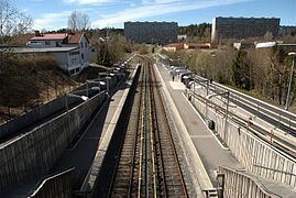
The railway station at Grorud, from 1854, is one of the oldest in Norway and was a hub of the whole Grorud valley for many years until the arrival of urbanization and the subway. Some of the old farms are still present in the Grorud landscape, although apartment buildings now are a more dominant part of the scenery.
The first Secretary-General of the United Nations, Trygve Lie came from Grorud.
Traditionally a borough inhabited by the working class, Grorud has in the last few decades had a great influx of immigrants. Because of these statistics Grorud is a recurring theme in Norwegian immigration politics.