
Prominence 182 ft (55 m) Elevation 1,896 m Parent range Sierra Nevada | Mountain range Sierra Nevada | |
 | ||
First ascent 1885 by Charles A. Bailey Easiest route Exposed scramble, class 3 Similar Mount Broderick, Liberty Cap, Mount Starr King, Eagle Peak, Mount Clark | ||
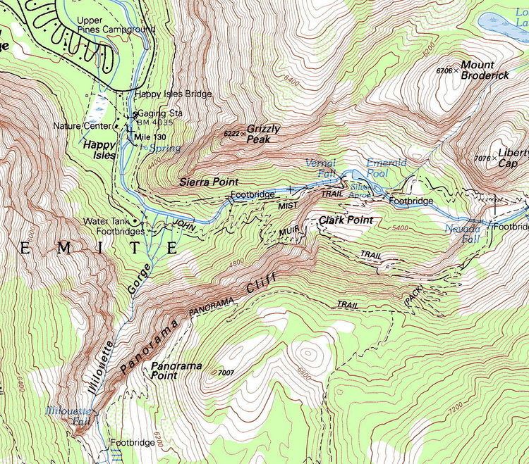
Grizzly Peak in Yosemite Valley is a promontory on the southwest wall below the popular Half Dome. It can be seen on the hike to Vernal Fall and Nevada Fall, from northeastern Glacier Point, and various other locations in the Yosemite Valley. The top is not accessible by any trail, although rock climbers frequent the peak.
Map of Grizzly Peak, California, USA
References
Grizzly Peak (Mariposa County, California) Wikipedia(Text) CC BY-SA